A Few of My Favorite Selfies

A Few of My Favorite Selfies

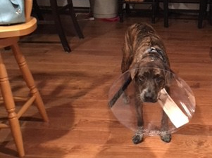
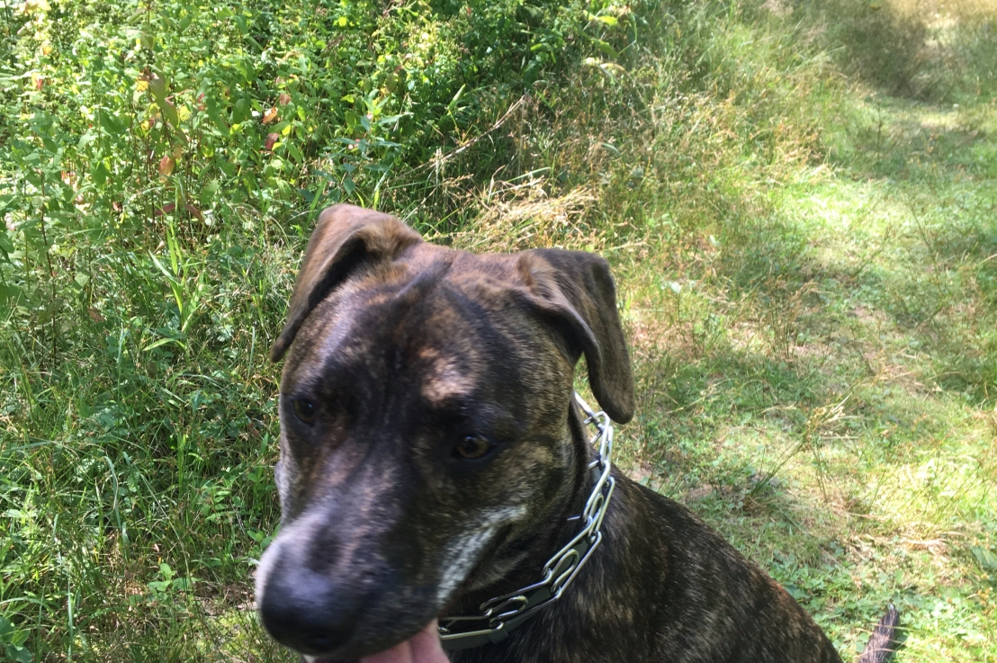
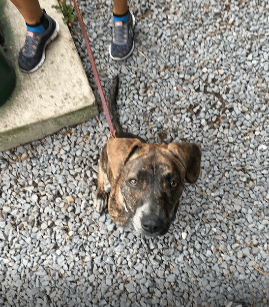
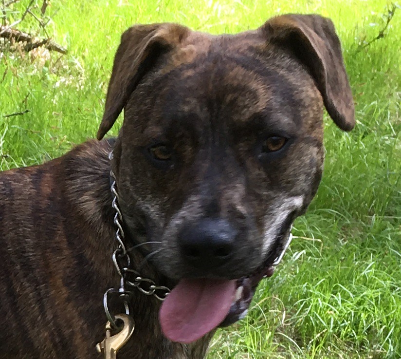
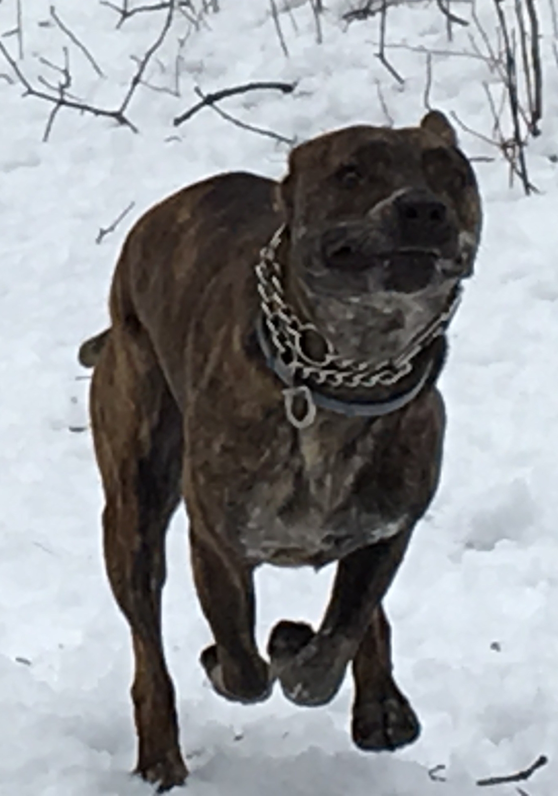
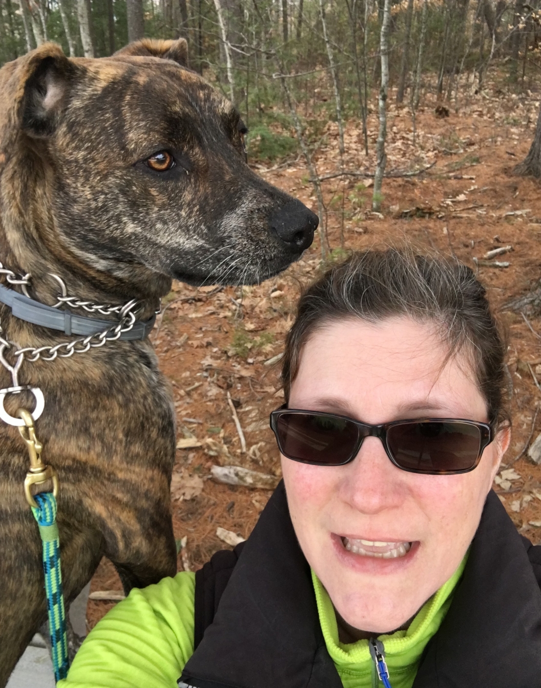
Whenever Mom and I go hiking, I can count on stopping a lot so she can pull out her phone. She loves taking photos of me. And, I don’t mind. After all, I can’t do it myself.

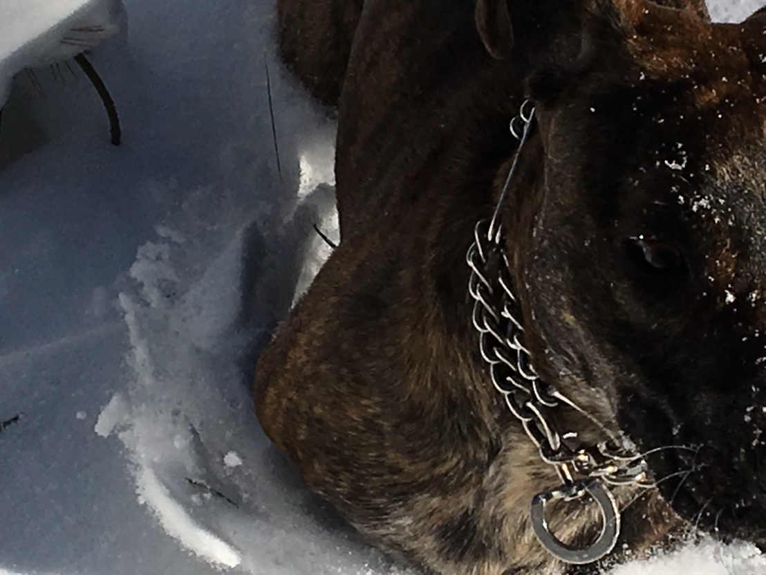
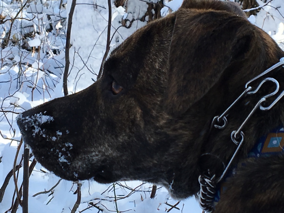
It’s so hot right now that I thought it would be cool (ha!) to share some of my favorite “selfies” from the last six months, starting with some snowy ones. I must say I wouldn’t mind rolling around in the white stuff right about now. And, I look gooood!

I’d love to see some of your selfies!
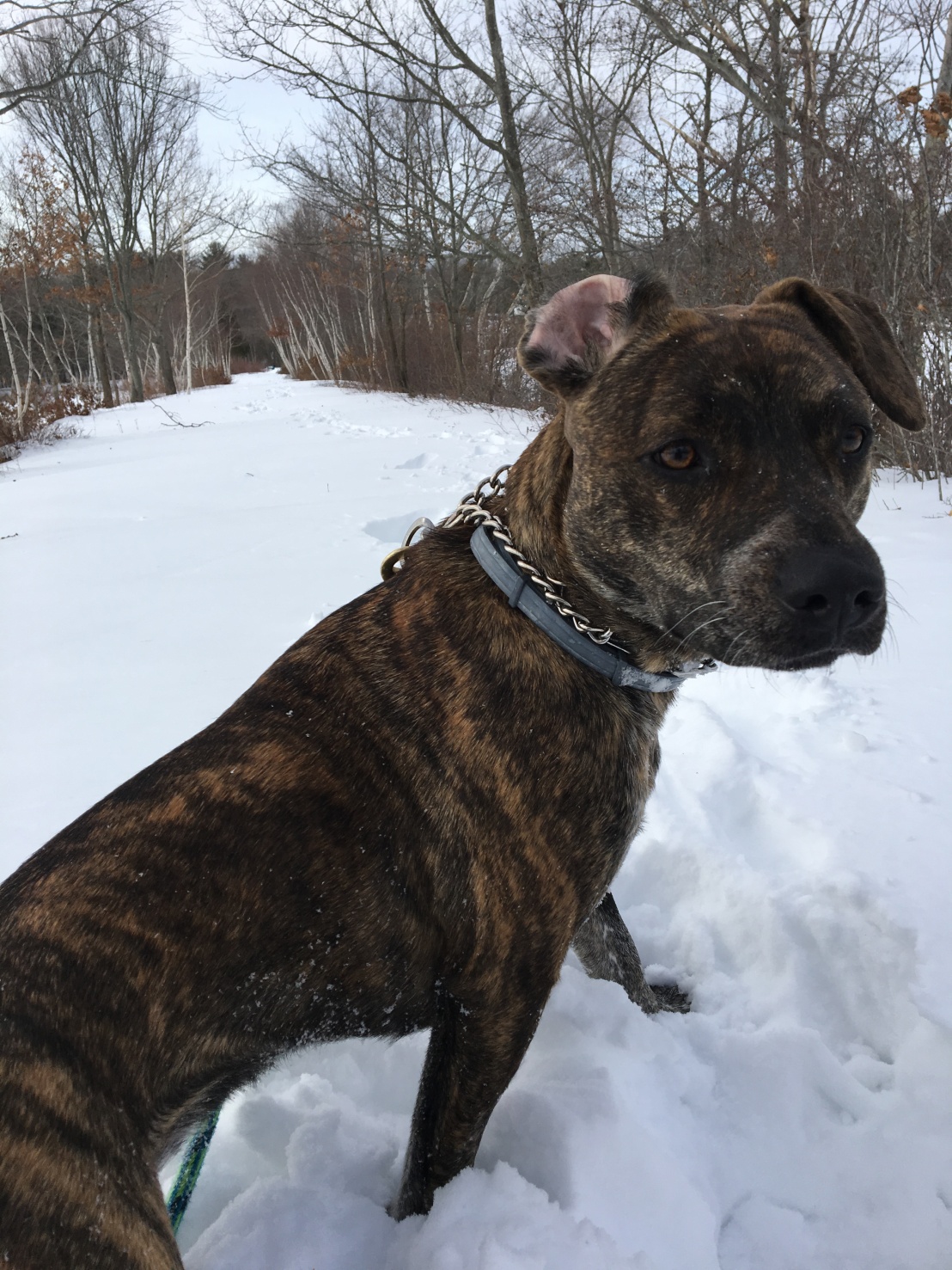
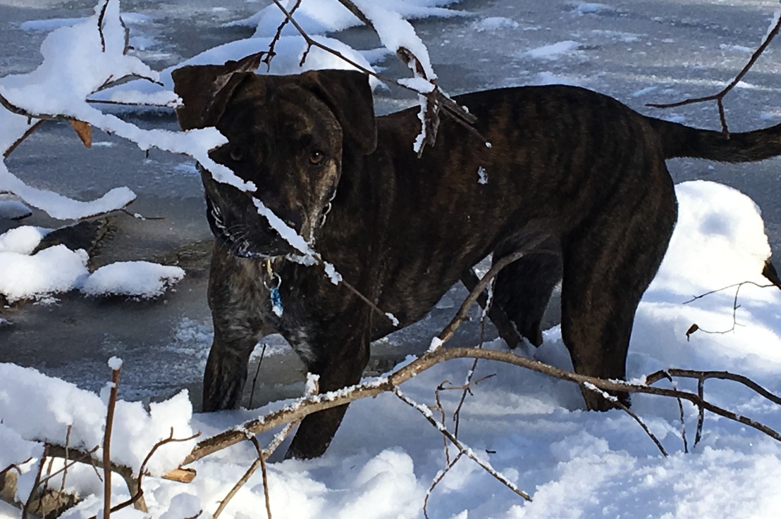
January 6

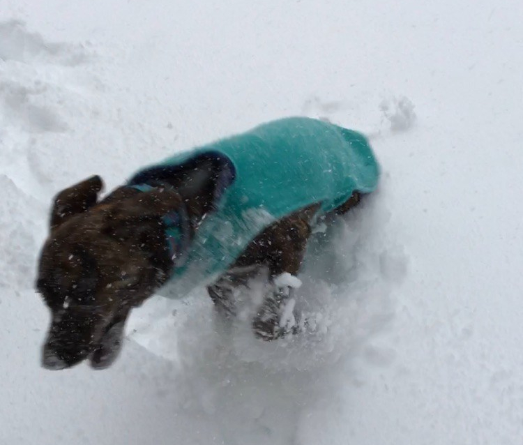
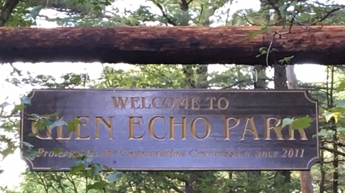
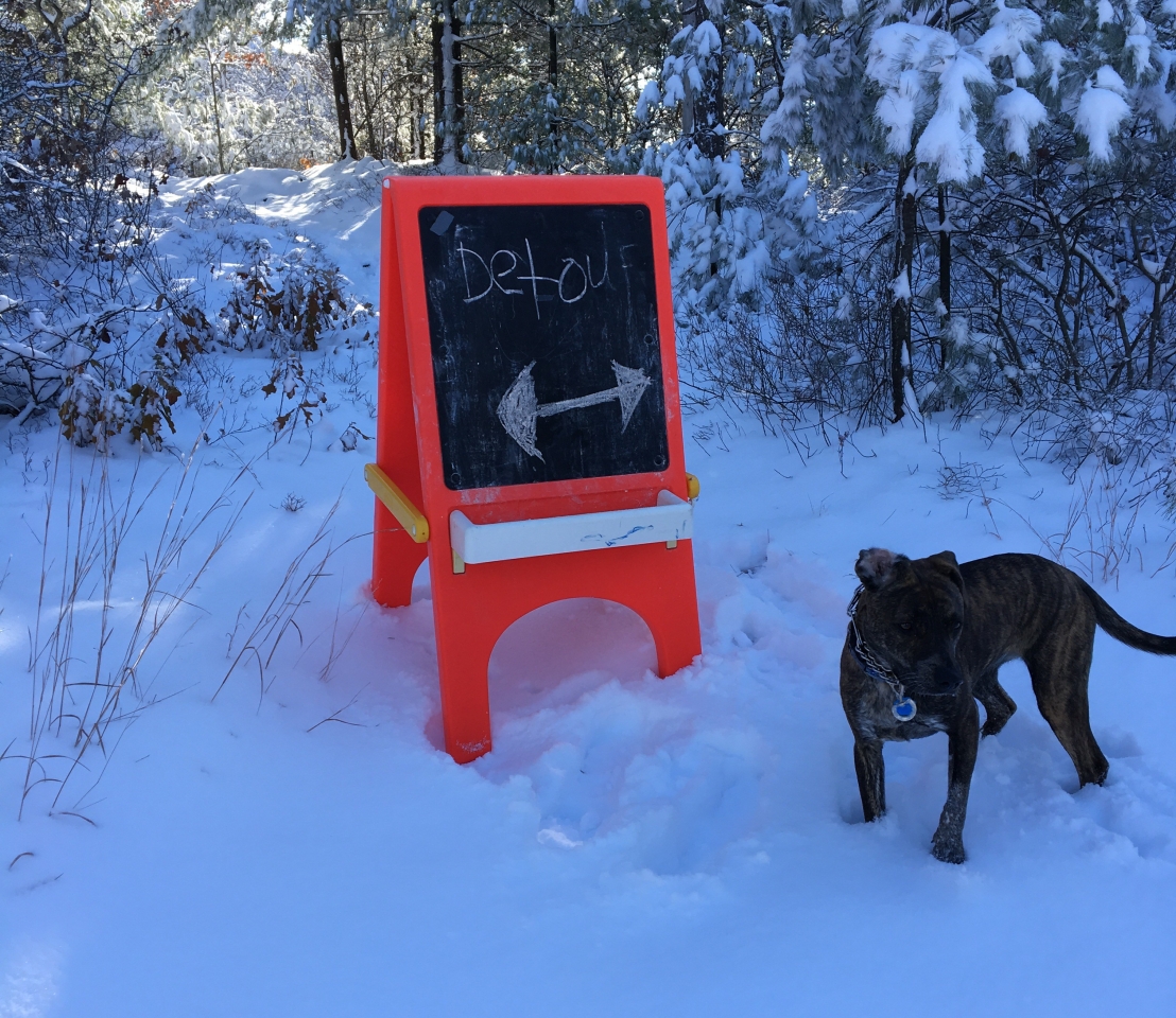
Here I am, romping in the snow at Glen Echo Park right here in Stoughton. The deeper the snow, the better!
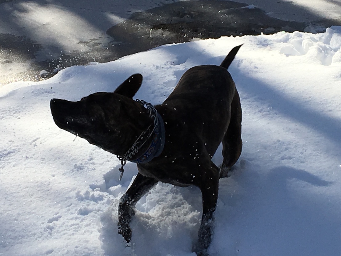
Super close up of Bella romping through the snow on January 6
I guess there is such a thing as being too close to the camera.

January 8

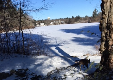
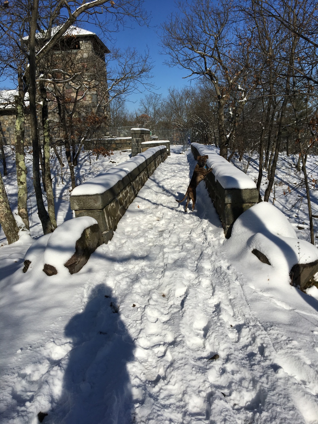
I remember this trip. Mom and I walked all the way around DW Field Park in the snow. And, when it was time to go back to the car, we decided to cut across the causeway to save some time. It took forever for us to make it all the way across—the snow came up to my chest and up to Mom’s knees.

I told her she shouldn’t have worn sneakers.
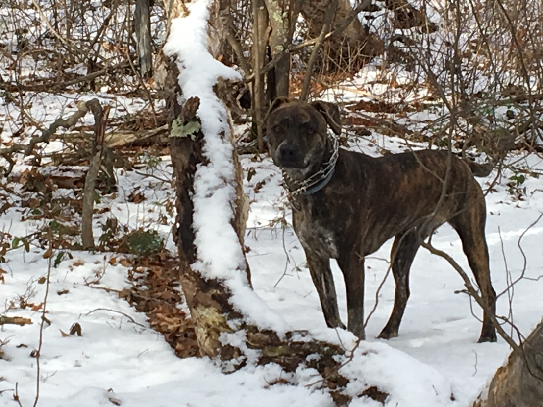
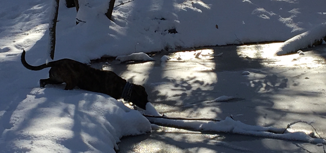
Bella in the snow at DW Field in Brockton
Striking a pose on the causeway at DW Field. Sometimes I flap my ear back so I can listen for approaching animals.

January 20

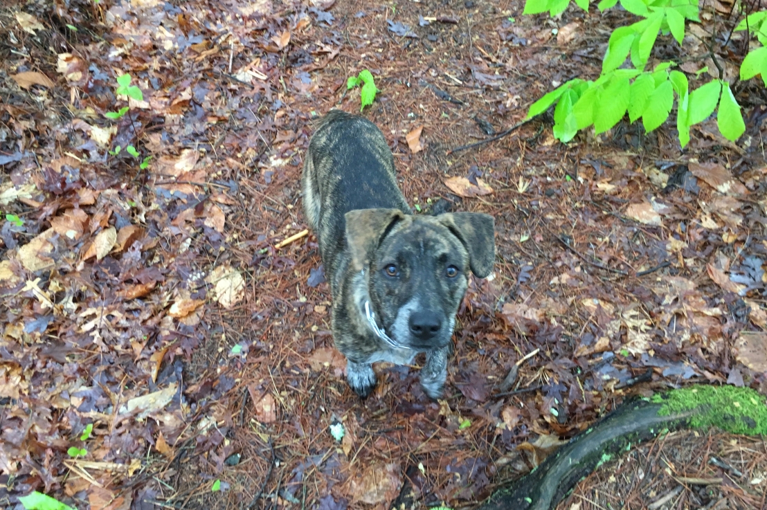
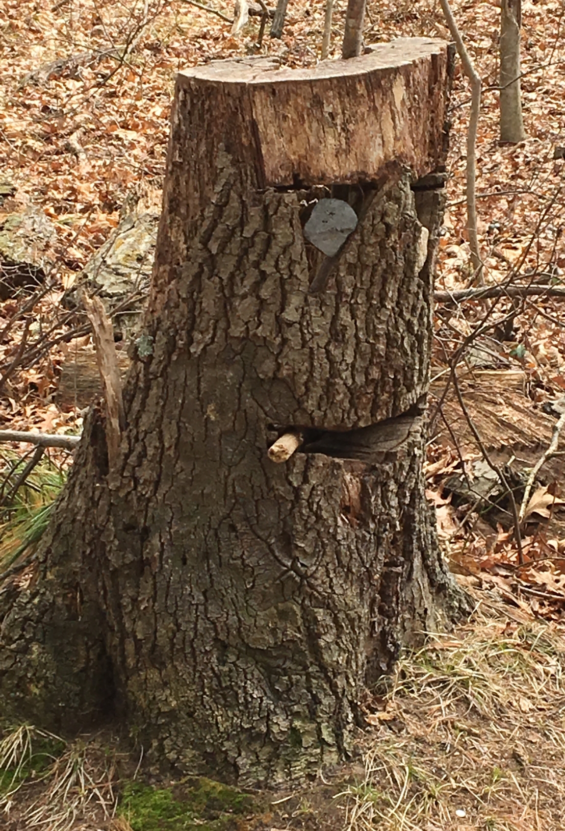
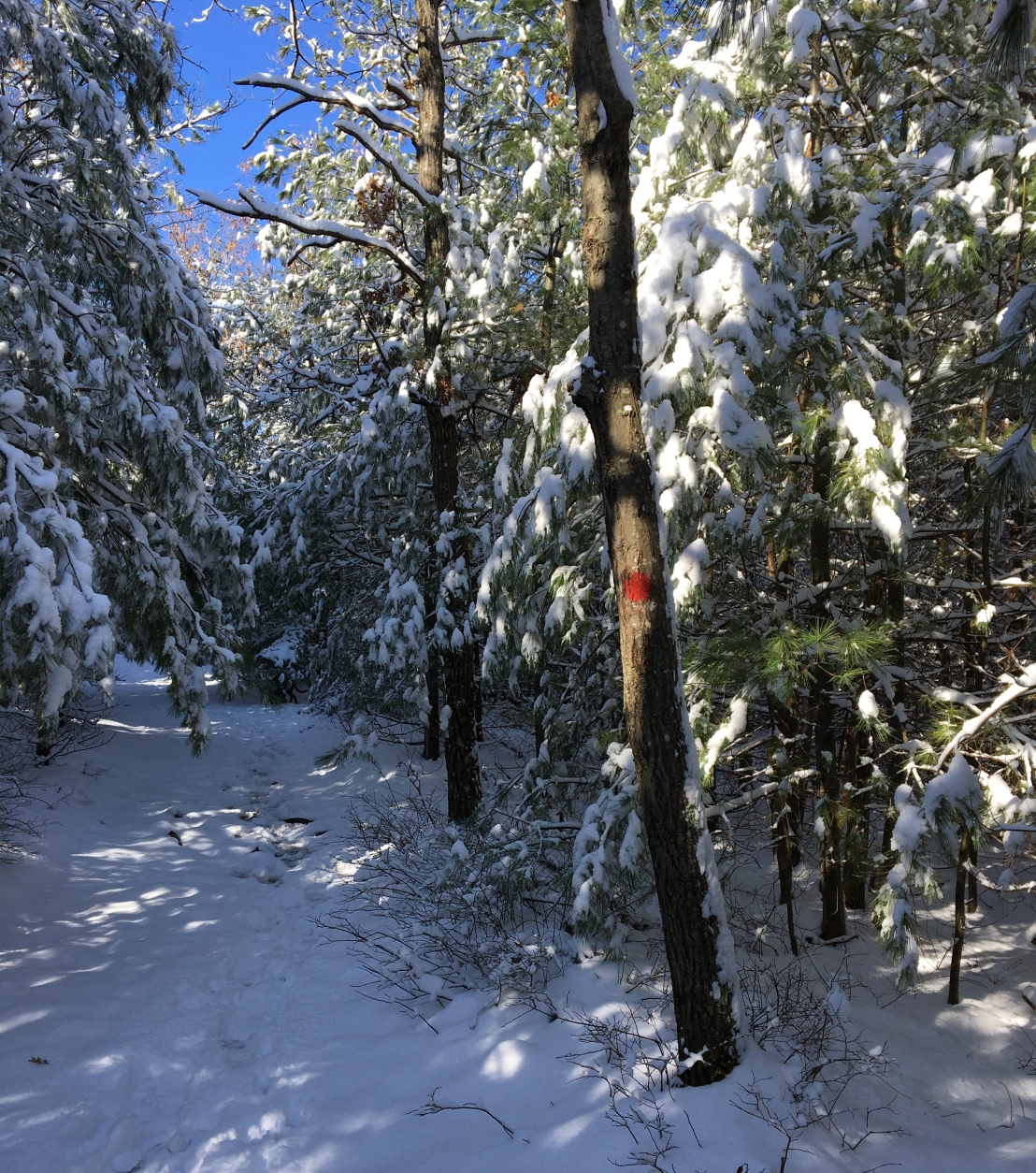
We didn’t stray very far afield when it was snowy out. Luckily we have Glen Echo Park right across the street from our house. There are always lots of trees that have fallen across the path so I always have something to climb over and chew on.
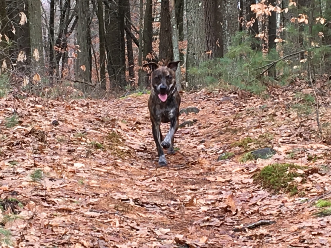
Bella standing beside a snow-covered log in Glen Echo Park
Hey, Mom! Take a picture of me with this log! Logs are my favorite!

February 10

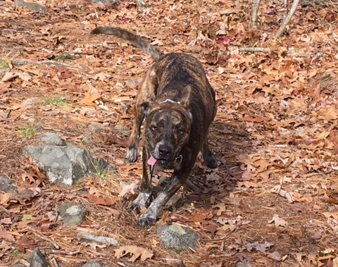
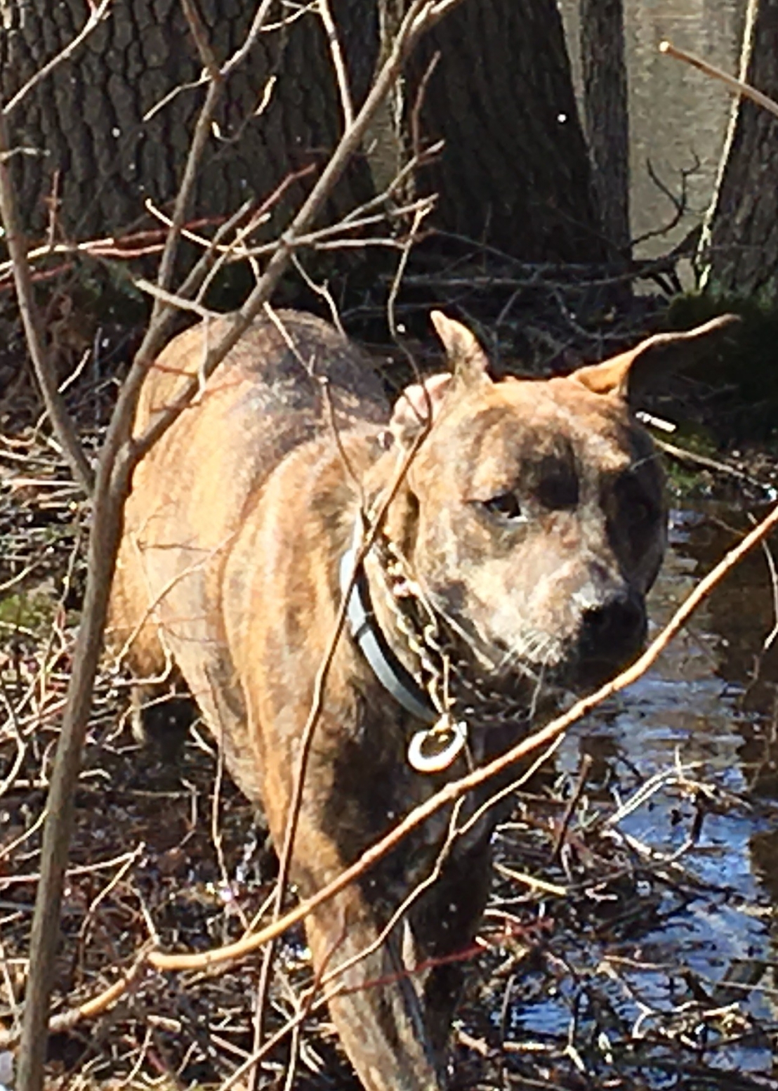
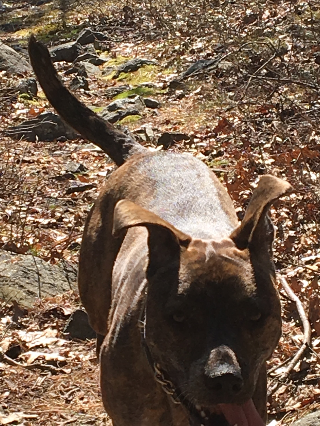
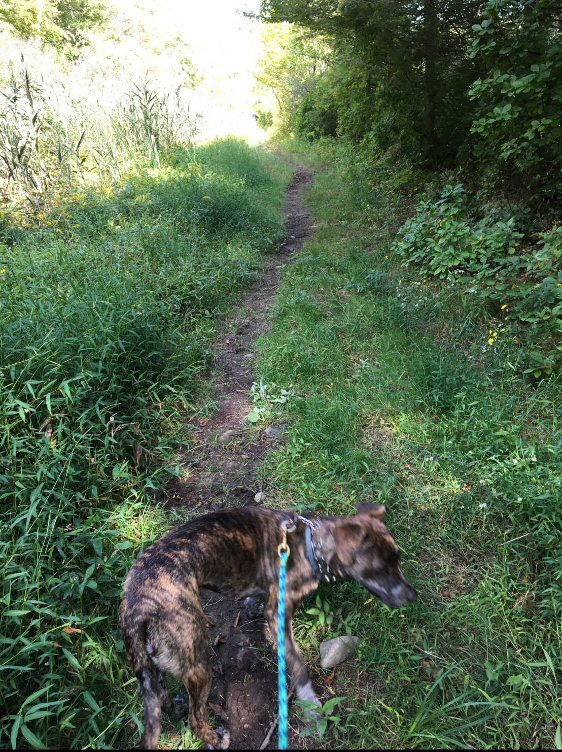
Wolcott Path was the perfect place to stretch my legs and pad along the leaf-packed trail. The January snow had melted, and we went about 6 miles that day!

Bella bounding along on Wolcott Path
Some people may think February is a dreary month, but I love it! The leaves feel good on my feet.

February 21 and 22

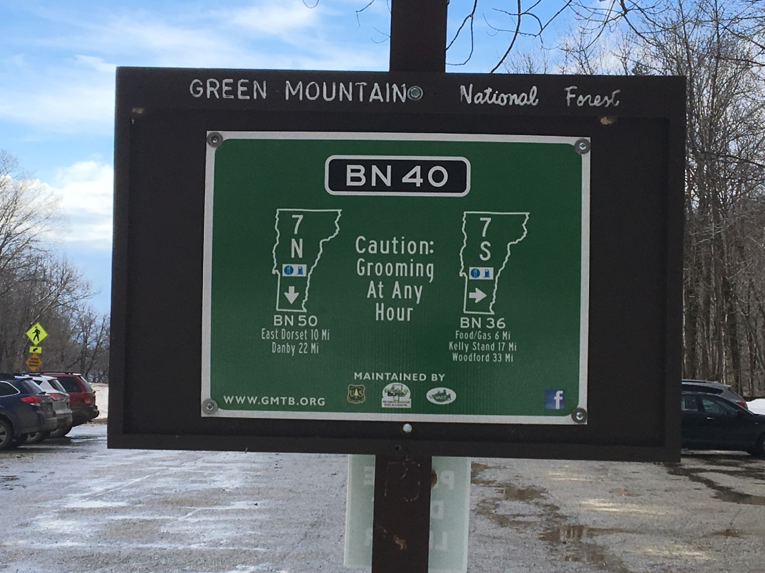
Late in February, my family left me behind for a ski trip to Vermont. I got to play with my friends at Dogtopia for a couple days. My family wore weird glasses on their faces and strapped sticks onto their feet so they could “ski” on the snow. That makes no sense to me.

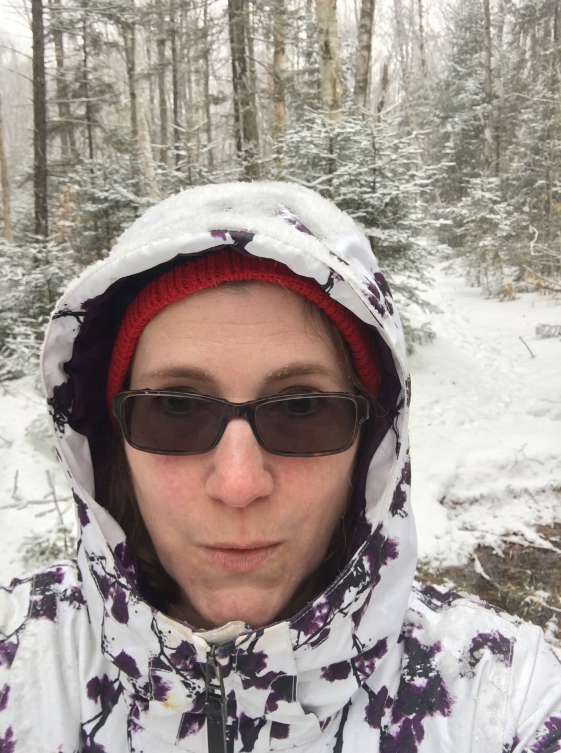
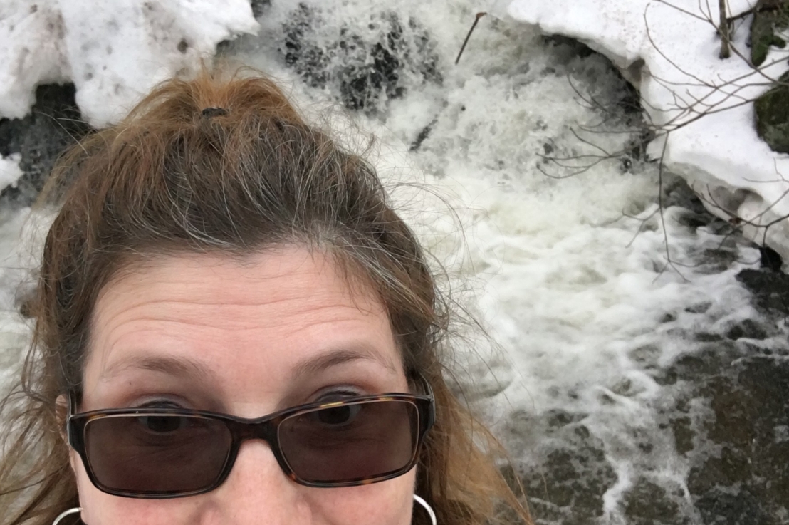
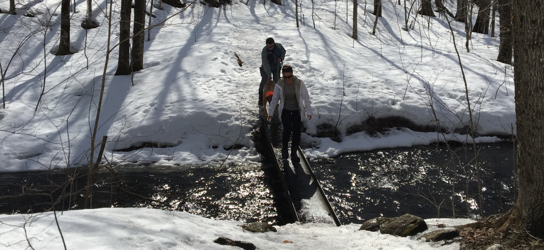
Here’s Mom taking a selfie while hiking Long Trail. In this area, it’s also part of the Appalachian Trail.

Mom takes a selfie on Long Trail in VT
I know what Mom’s thinking. “I can’t believe we left Bella at home while I go hiking all by myself.”

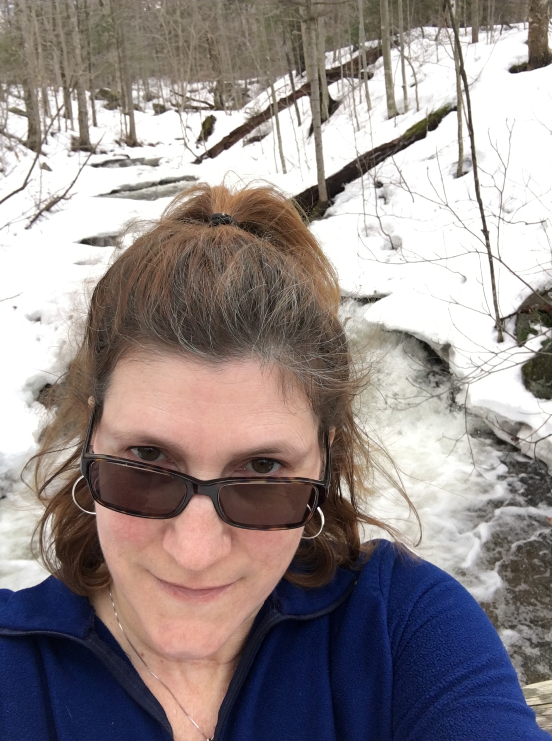
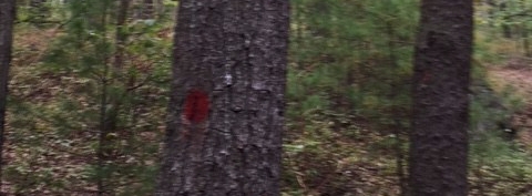
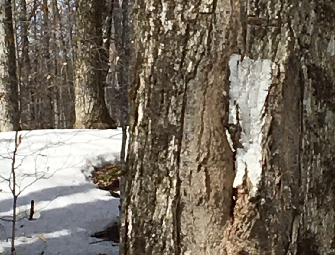
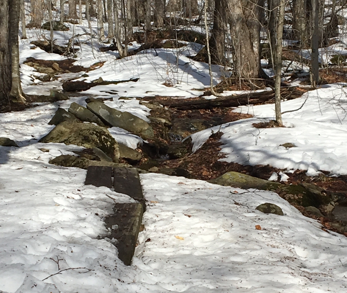
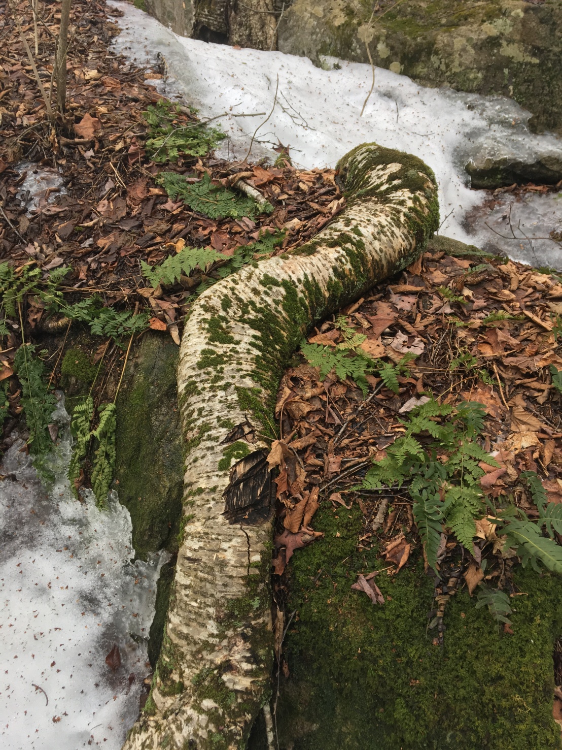
And, here she is hiking near Grout Pond. It looks like it had been snowing pretty hard, but she said the trail was well marked. Too bad there was so much snow melting under the surface crust. She told me she had to turn back because she forgot her hiking boots and didn’t want to get her feet wet!

Mom at Grout Pond near Stratton Mountain
Mom stops for a selfie at Grout Pond near Stratton Mountain.

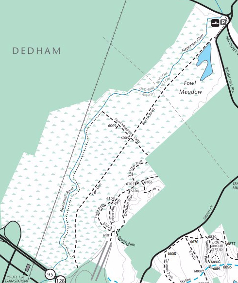
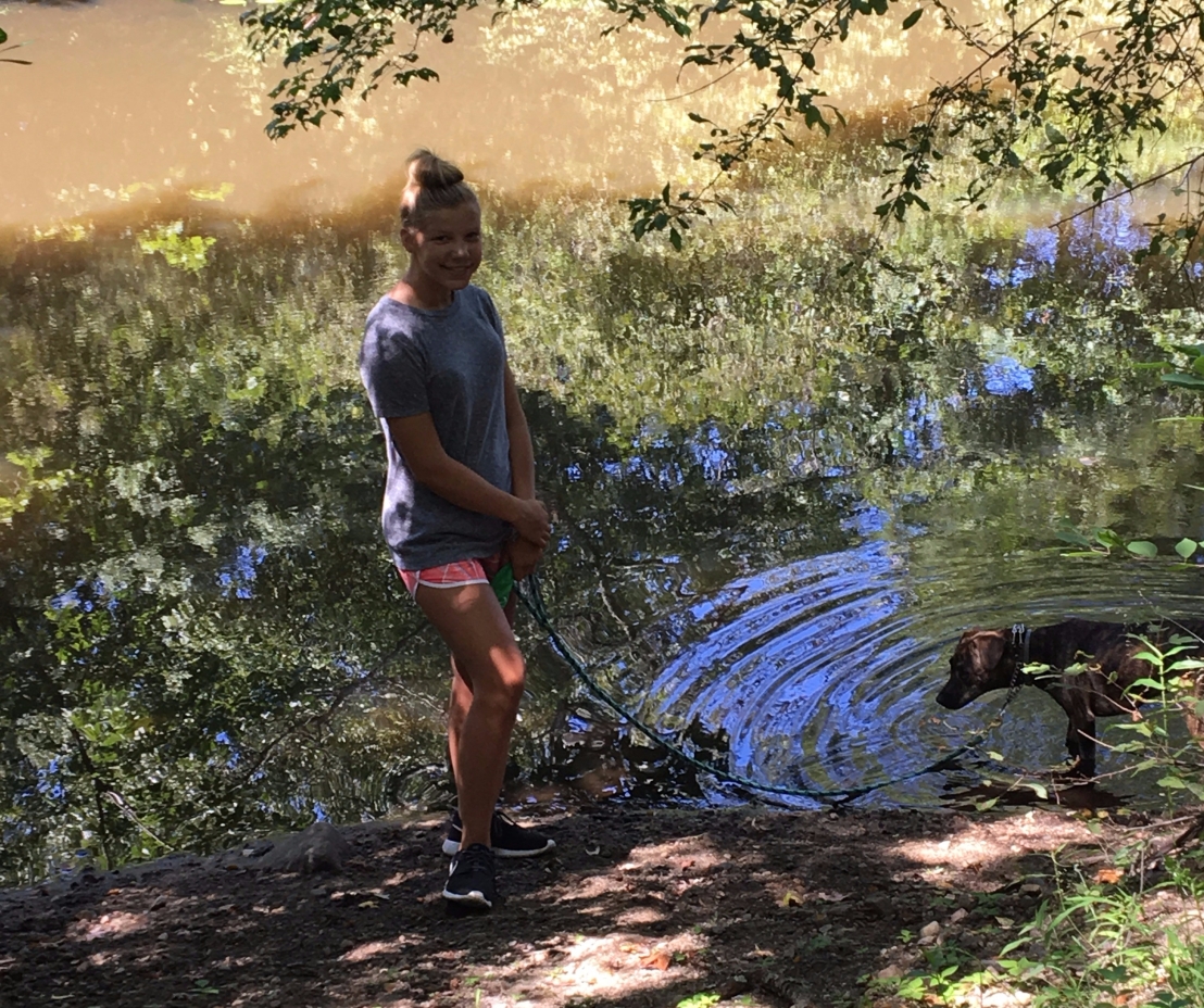
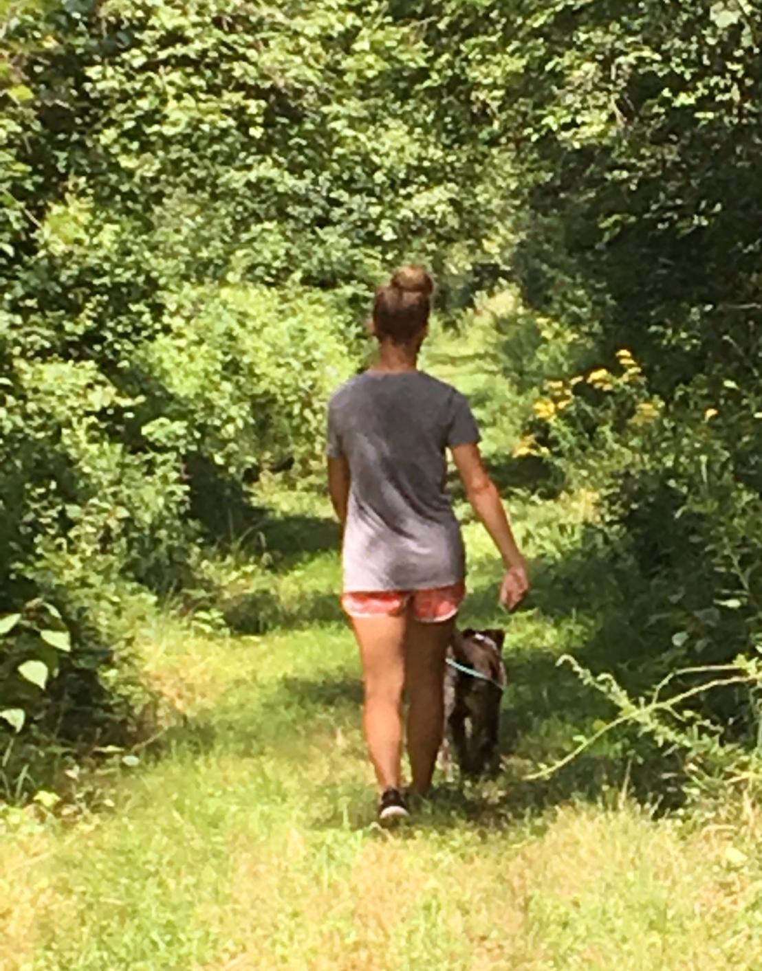
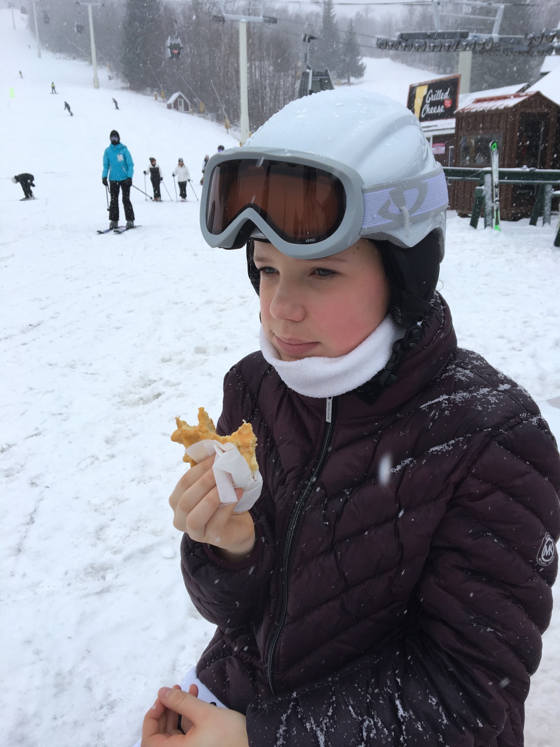
Haley hasn’t gone hiking with us since we wandered Fowl Meadow in the blazing heat back in August. She definitely preferred to go skiing at Stratton Mountain.

Haley at Stratton enjoying a waffle
My sister enjoys a waffle at Stratton Mountain. (BTW, I’m still mad they left me home for this trip. I could have helped her finish off that last bite.)

March 9

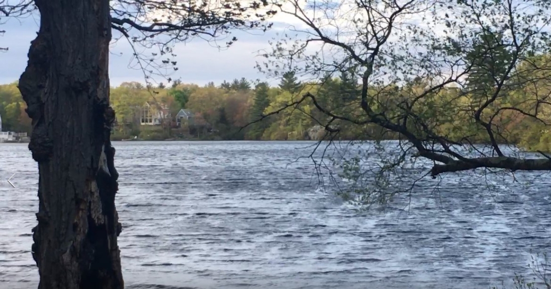
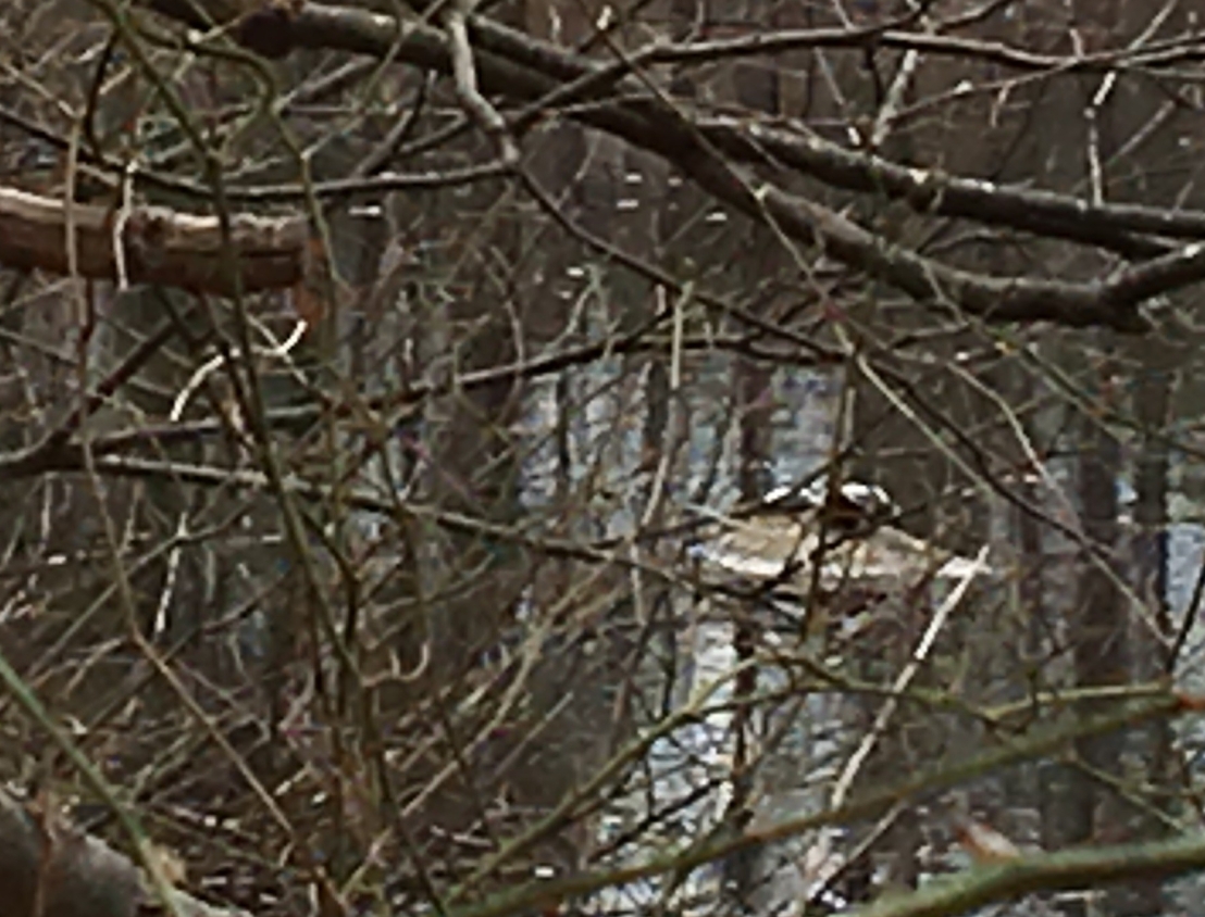
There were two big white birds swimming around Glen Echo Lake while we were there. I raced over to tell Mom, but she’d already seen them. She said they are called swans. I think those birds were trying to tell me something. They kept making weird honking sounds. I really wanted to chase them, but I would have had to swim, and the water was too cold. So, I chased Mom instead!
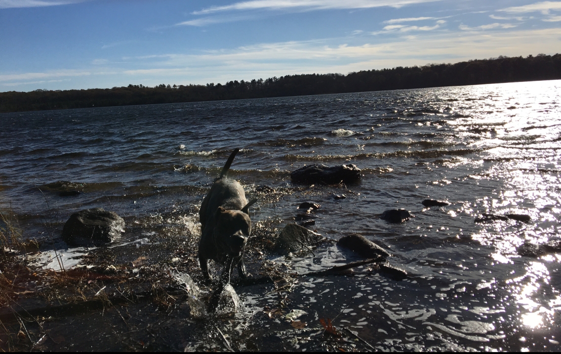
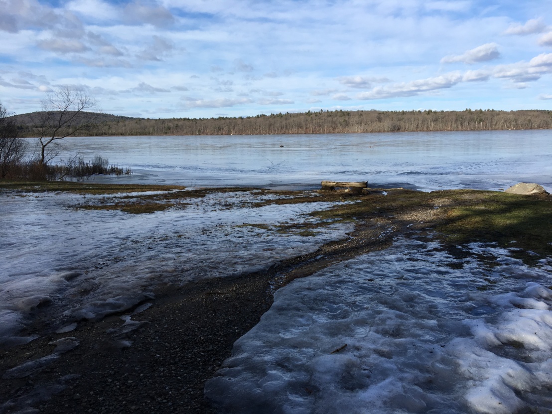
Bella galloping around Glen Echo in the snow
I’m coming, Mom!

March 26

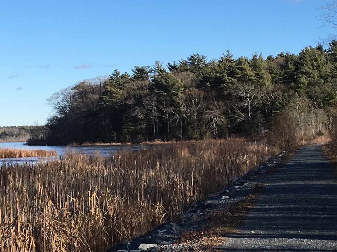
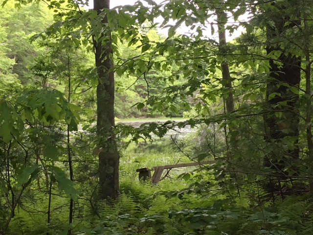
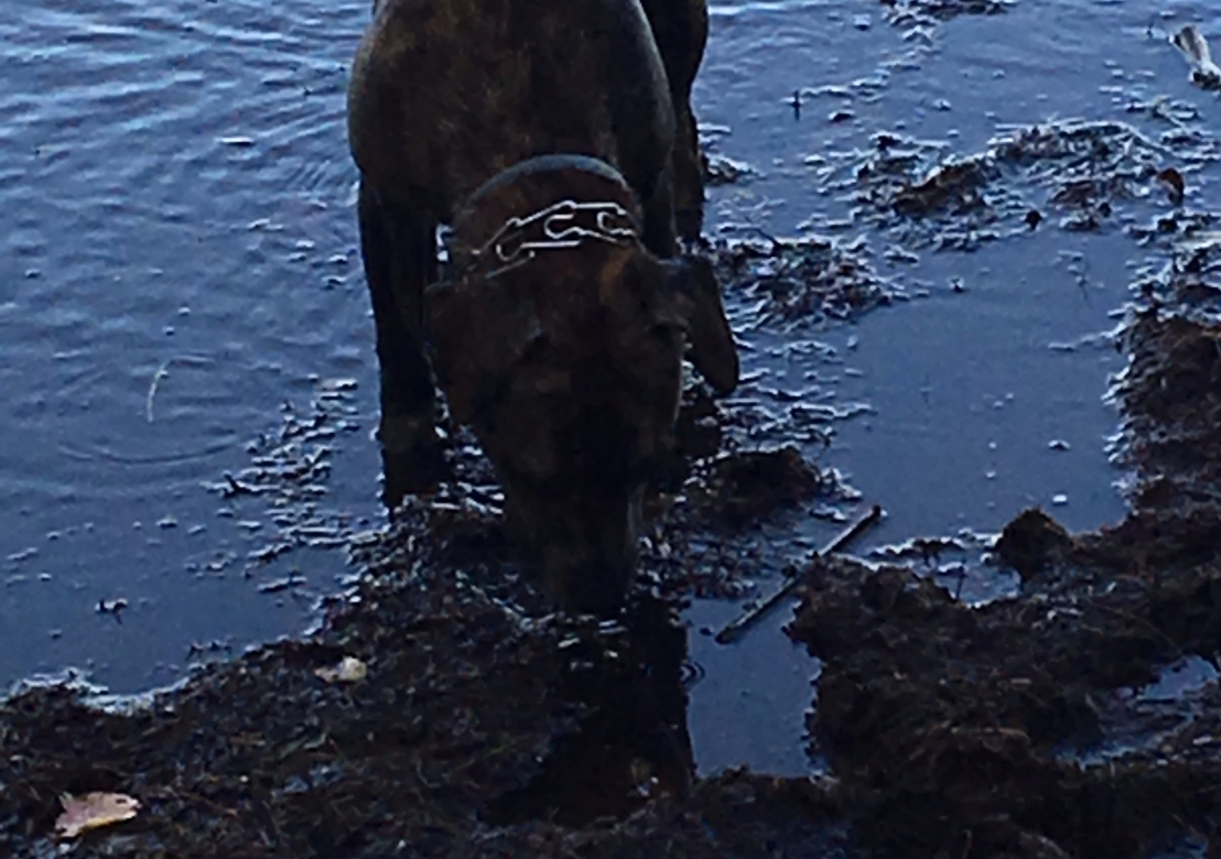
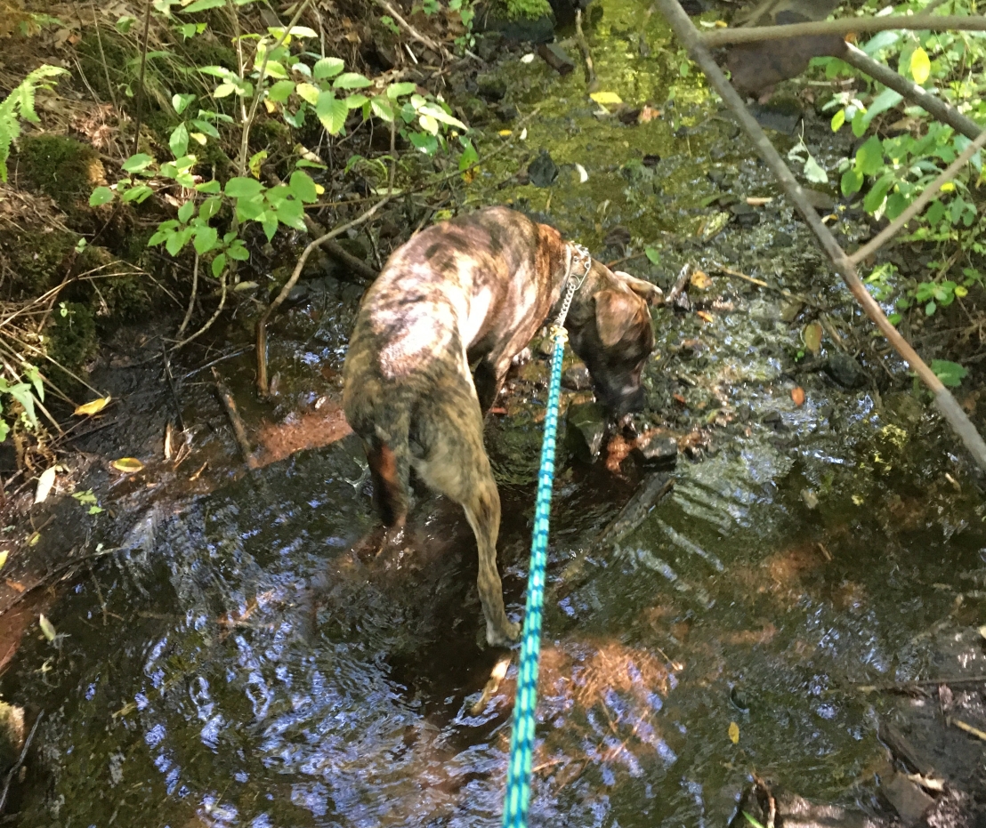
The snow finally started to melt so I could get my feet wet at Ponkapoag Pond. The sunshine felt warm, but the water was cold!

Bella walks along the cold water's edge of Ponkapoag Pond
Walking around Ponkapoag got a little wetter once Spring got here.

March 31

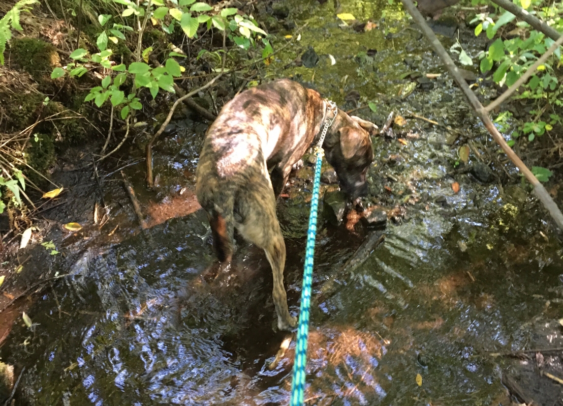
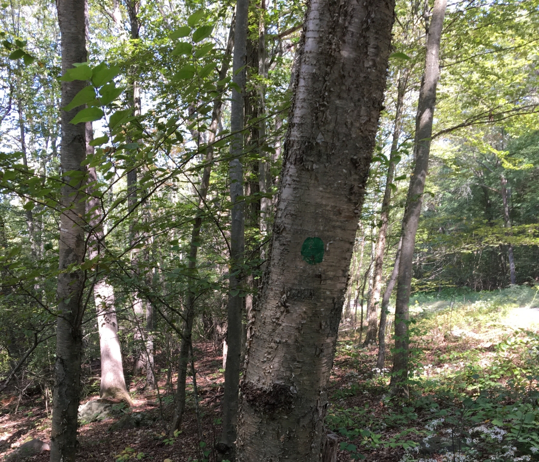
We took a long car ride to visit my cousin Coco in Gorham, Maine. While we were there, Mom and I checked out Claire Drew Trails. The snow hadn’t quite melted all the way, so it was squishy in some places.

Mom and Bella take a selfie on Claire Drew Trails
You take a selfie, Mom. I’ll stand lookout.

April 7

This was one of our longest hikes of the spring. We parked in one of the lots on Route 28, and went up Hawk Hill. Then we wandered around the top for a while until we found a trail down. It was fun, but I think Mom was getting frustrated!

Bella wandering around Hawk Hill
Mom, don’t you know how to read a trail map? It’s time to go down!

April 14

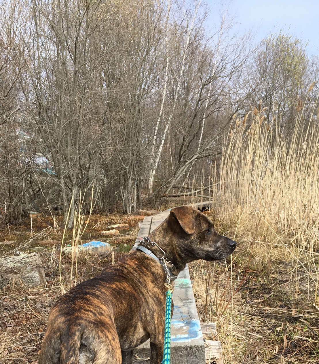
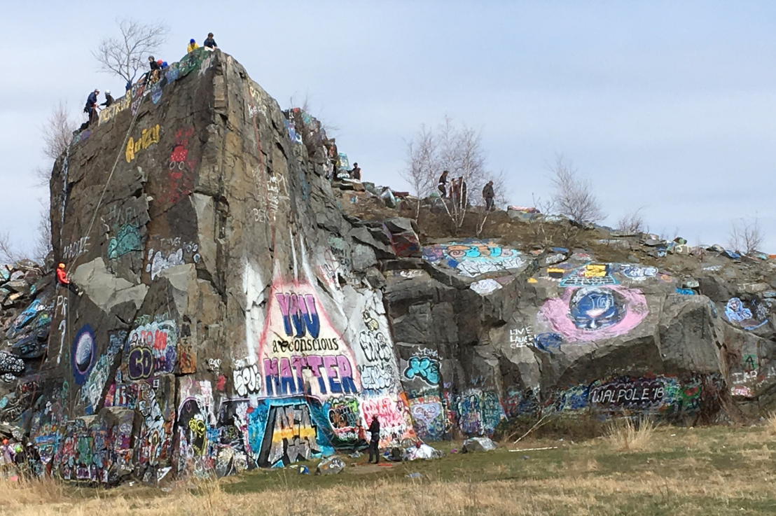
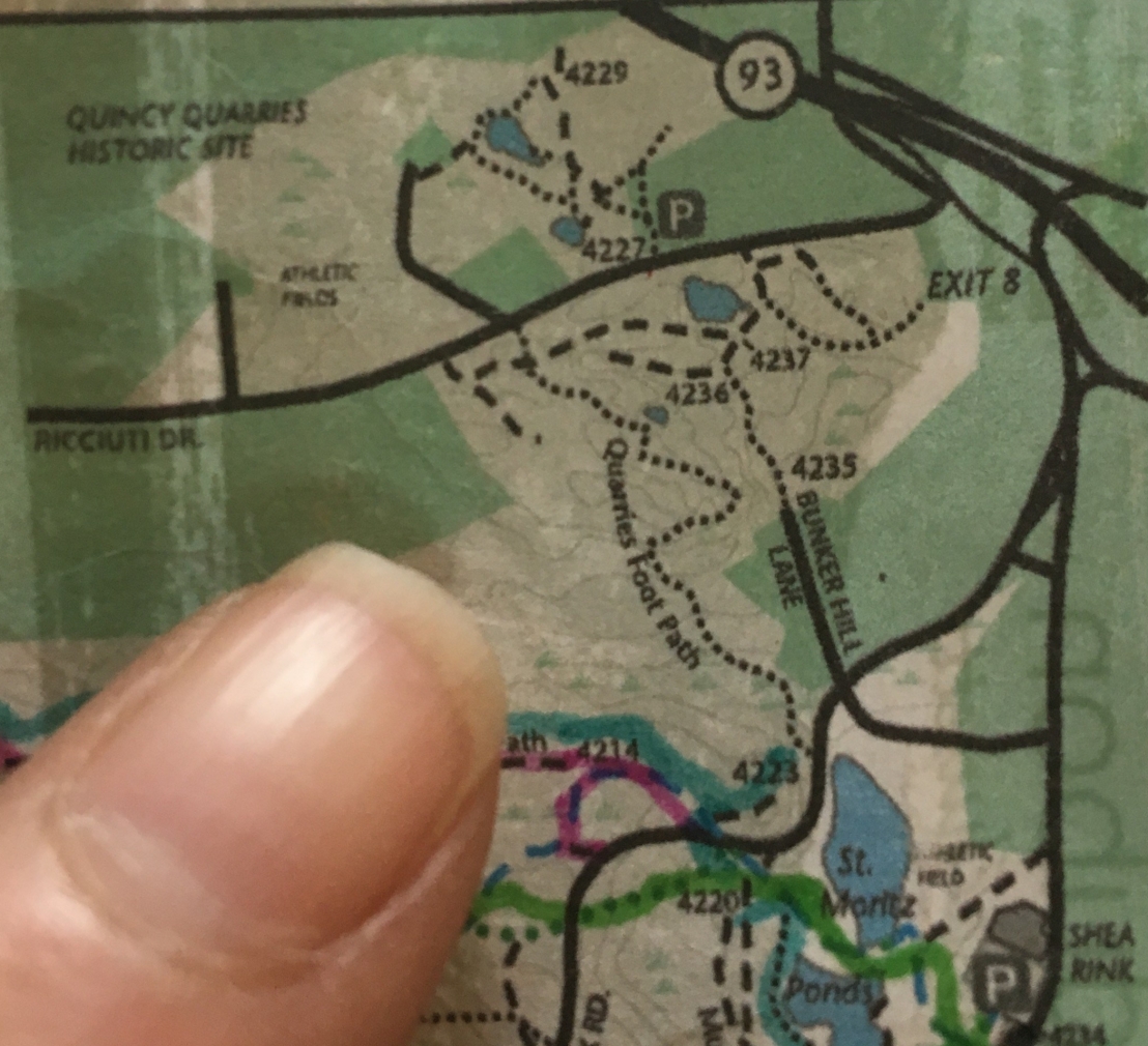
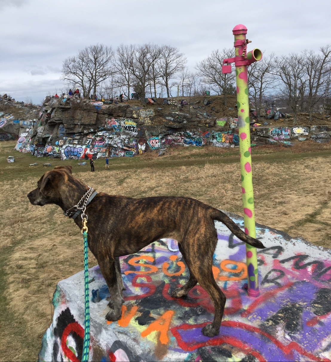
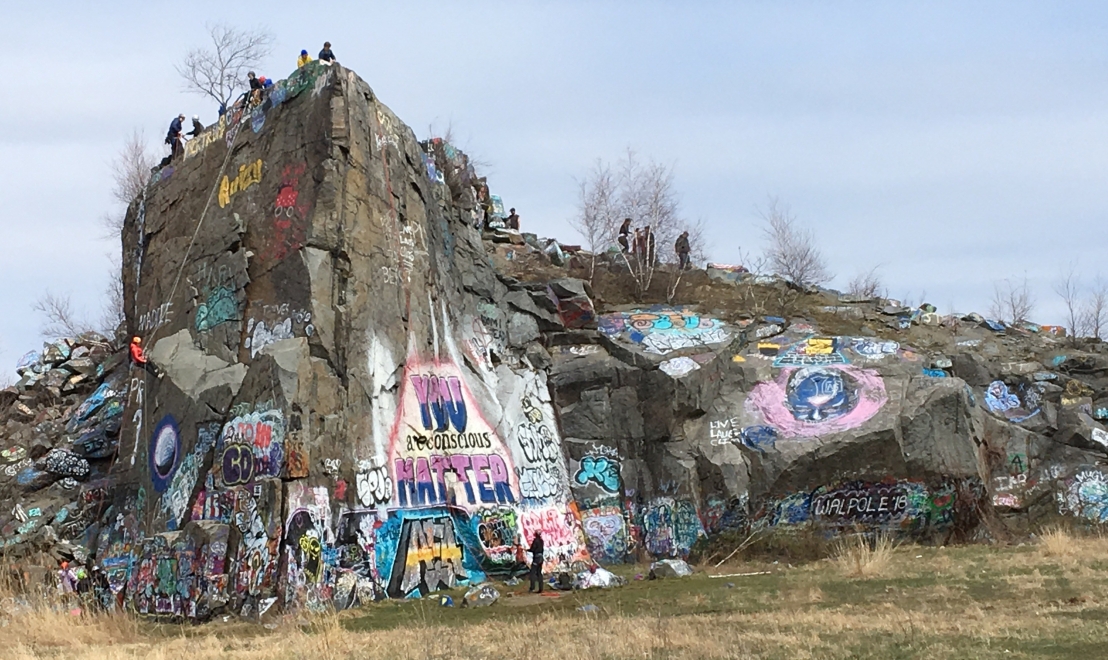
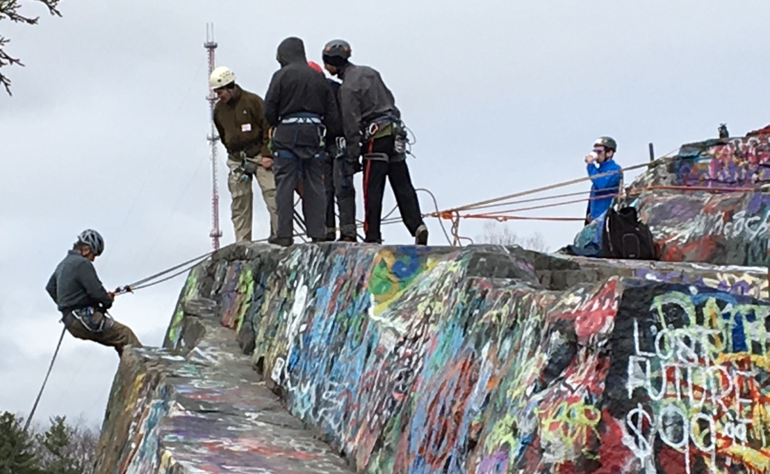
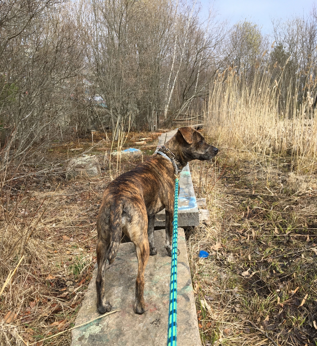
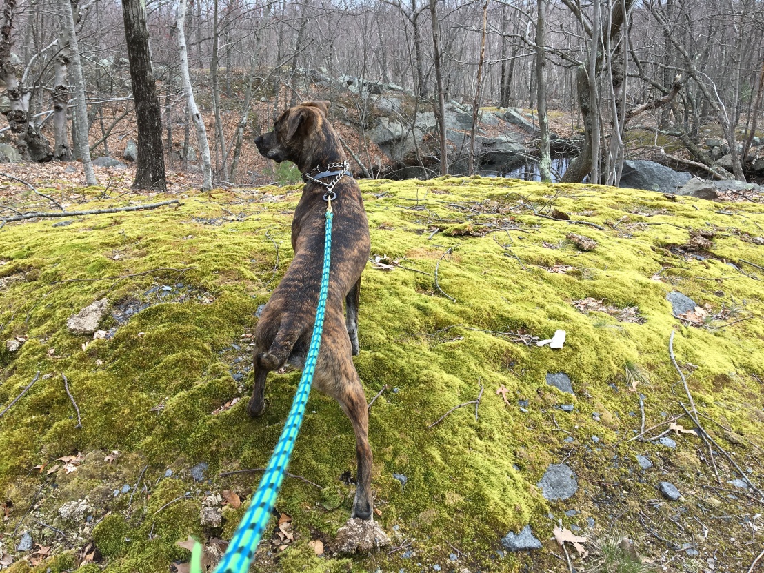
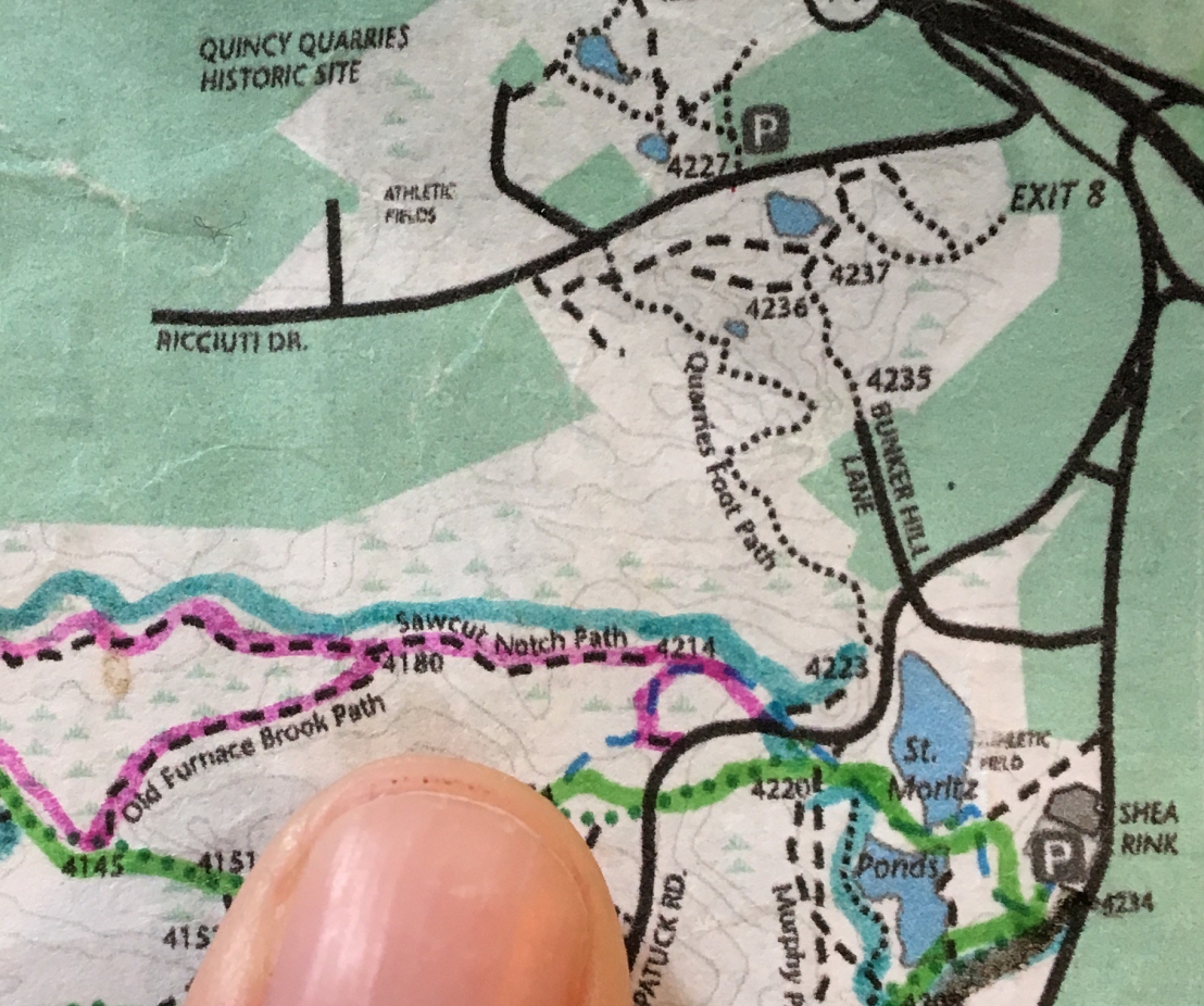
I couldn’t take my eyes off the people climbing up and down the rock faces at Quincy Quarries. I still can’t figure out what they were doing up there. But, at least we got to walk all around the cliffs and along this boardwalk to the back side.

Bella watches the rock climbers at Quincy Quarries
What on Earth are they doing over there on those rocks?

May 5

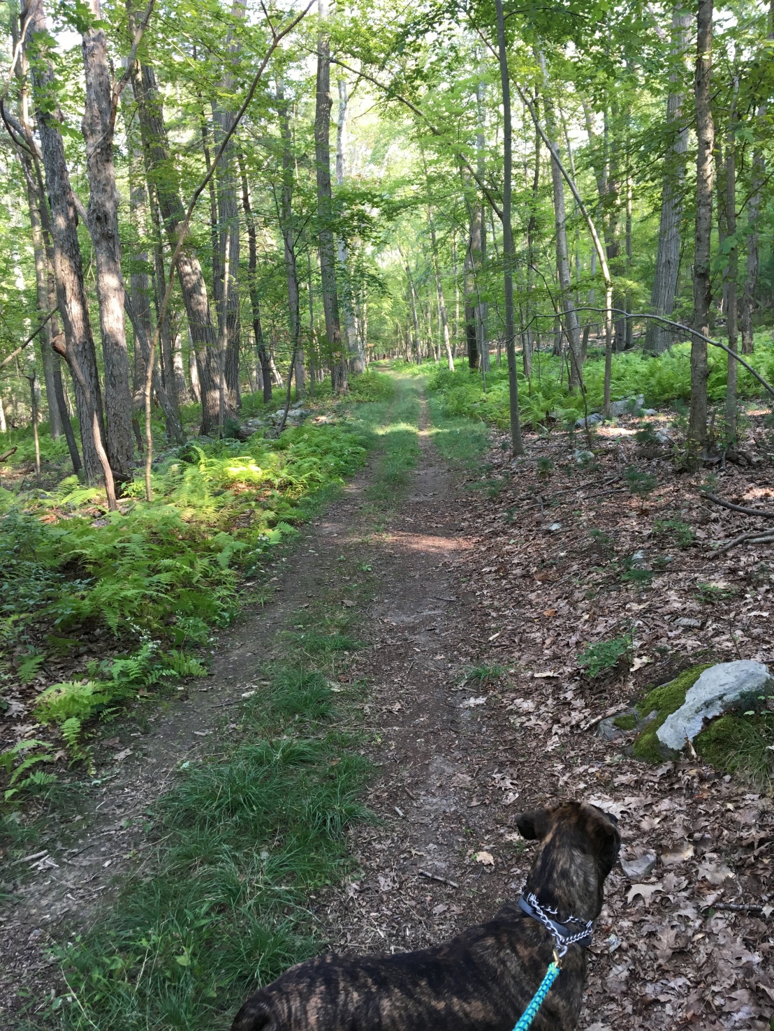
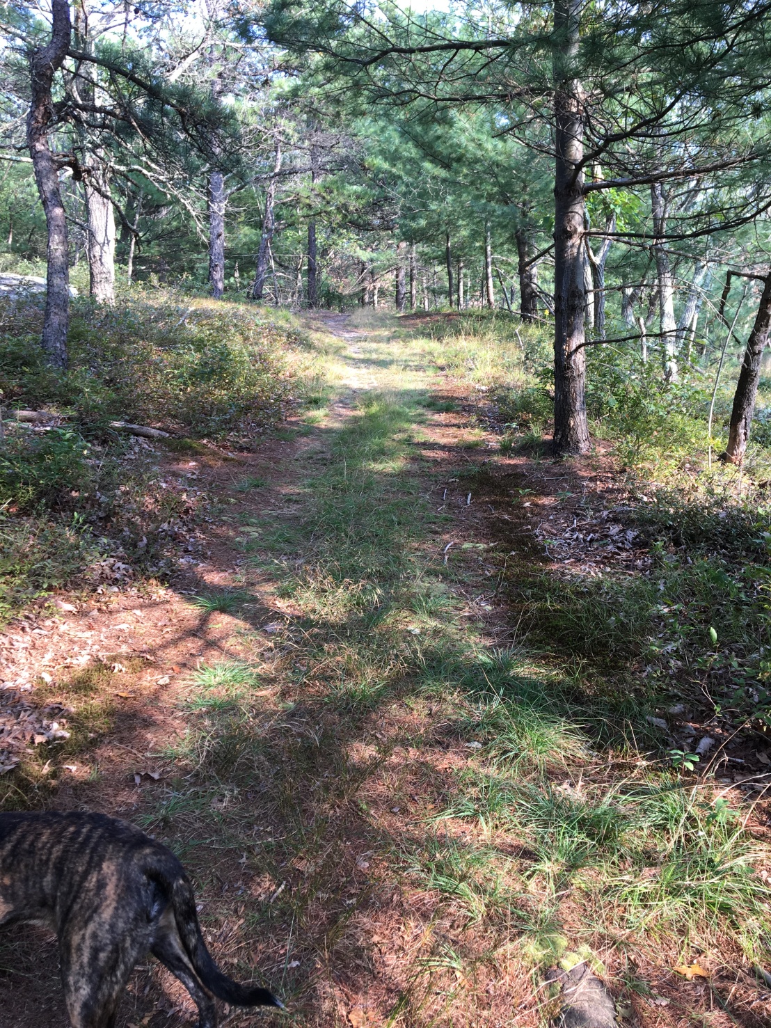
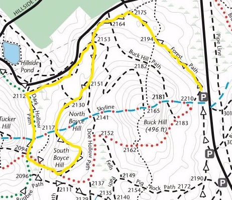
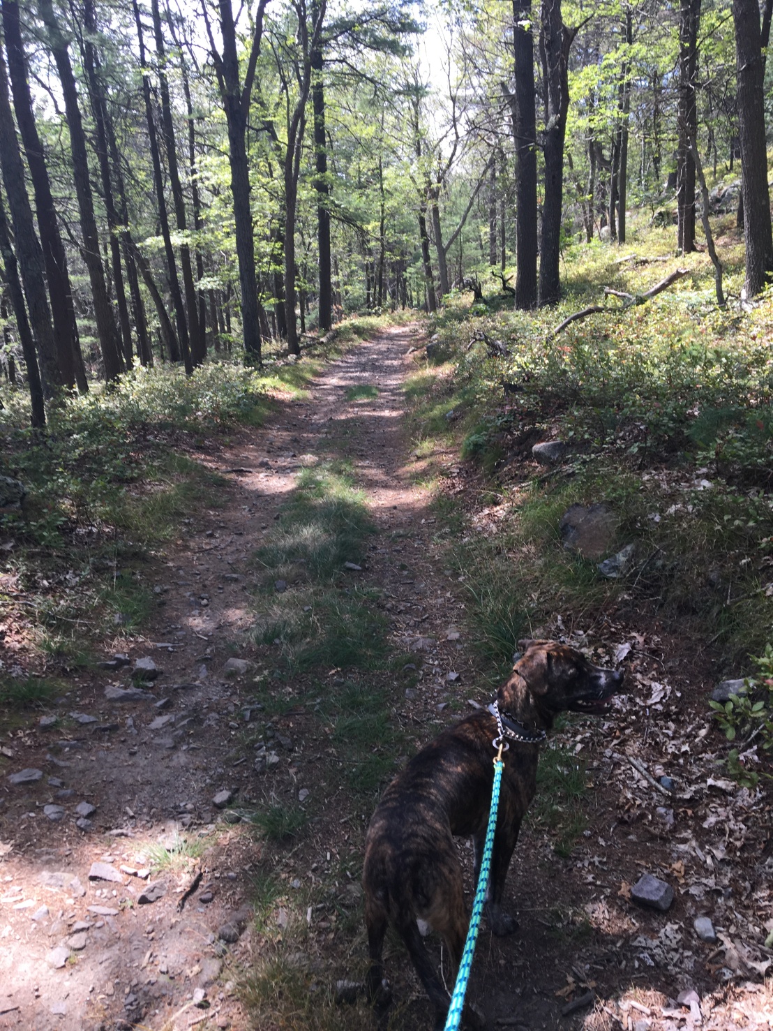
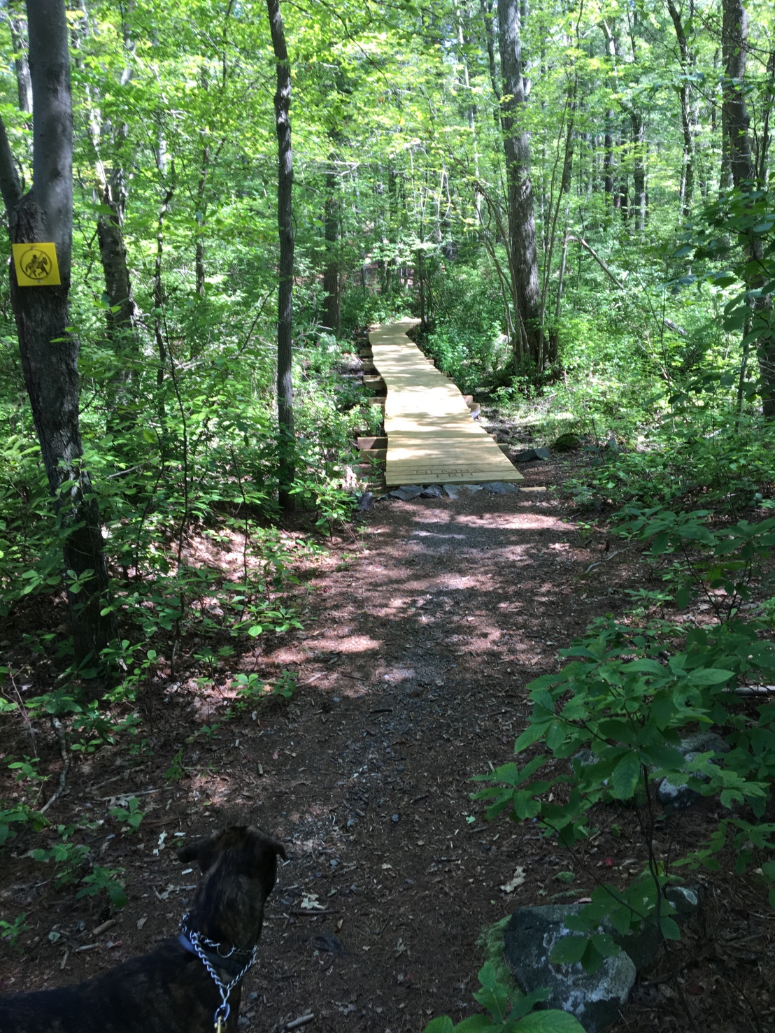
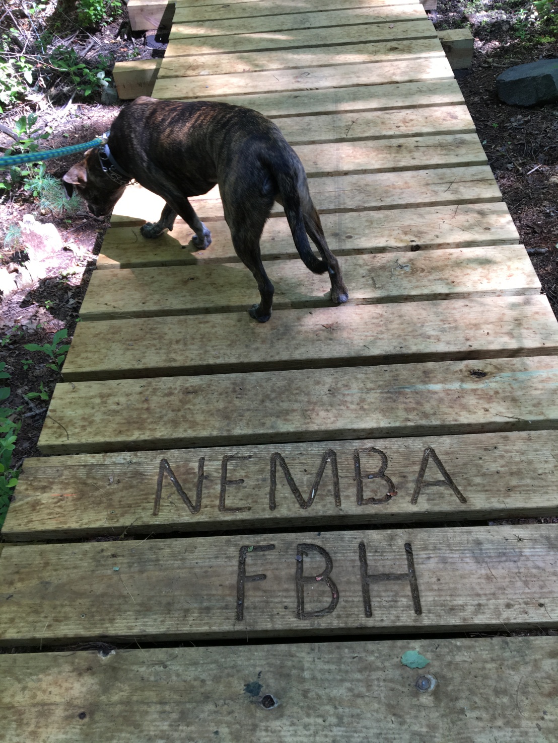
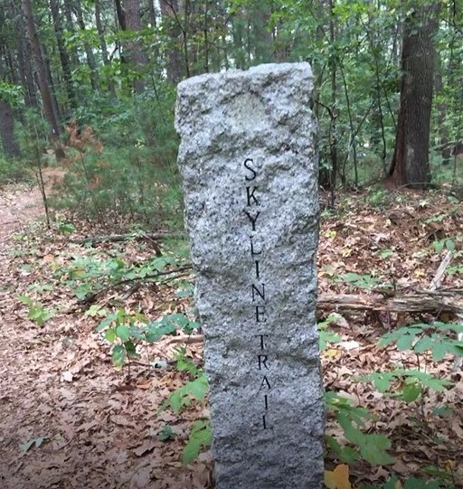
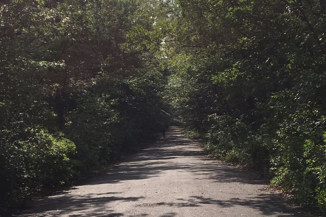
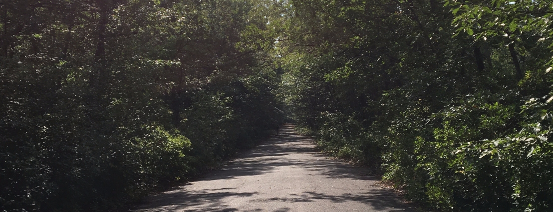
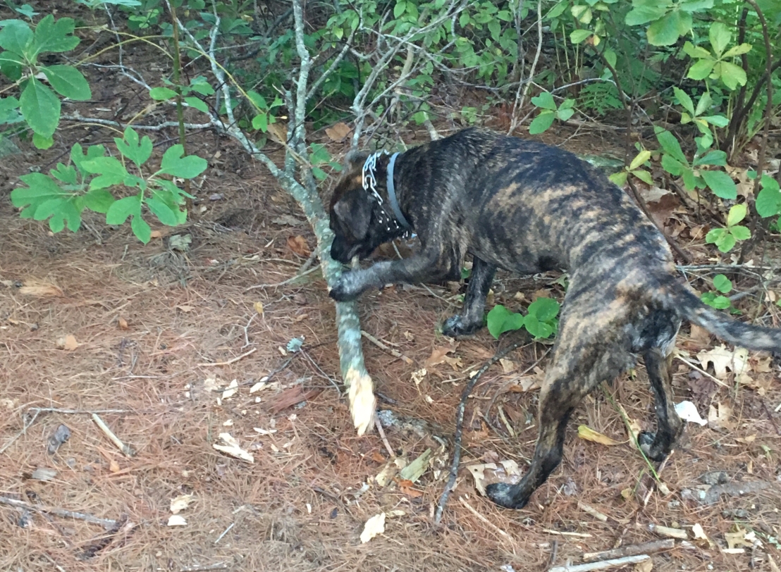
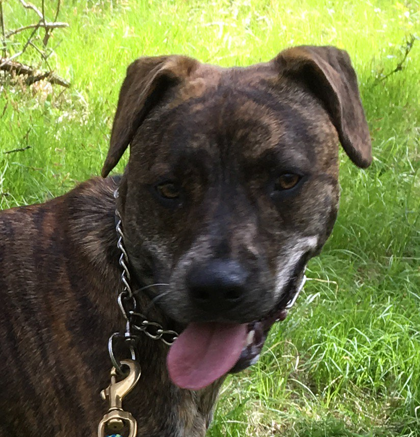
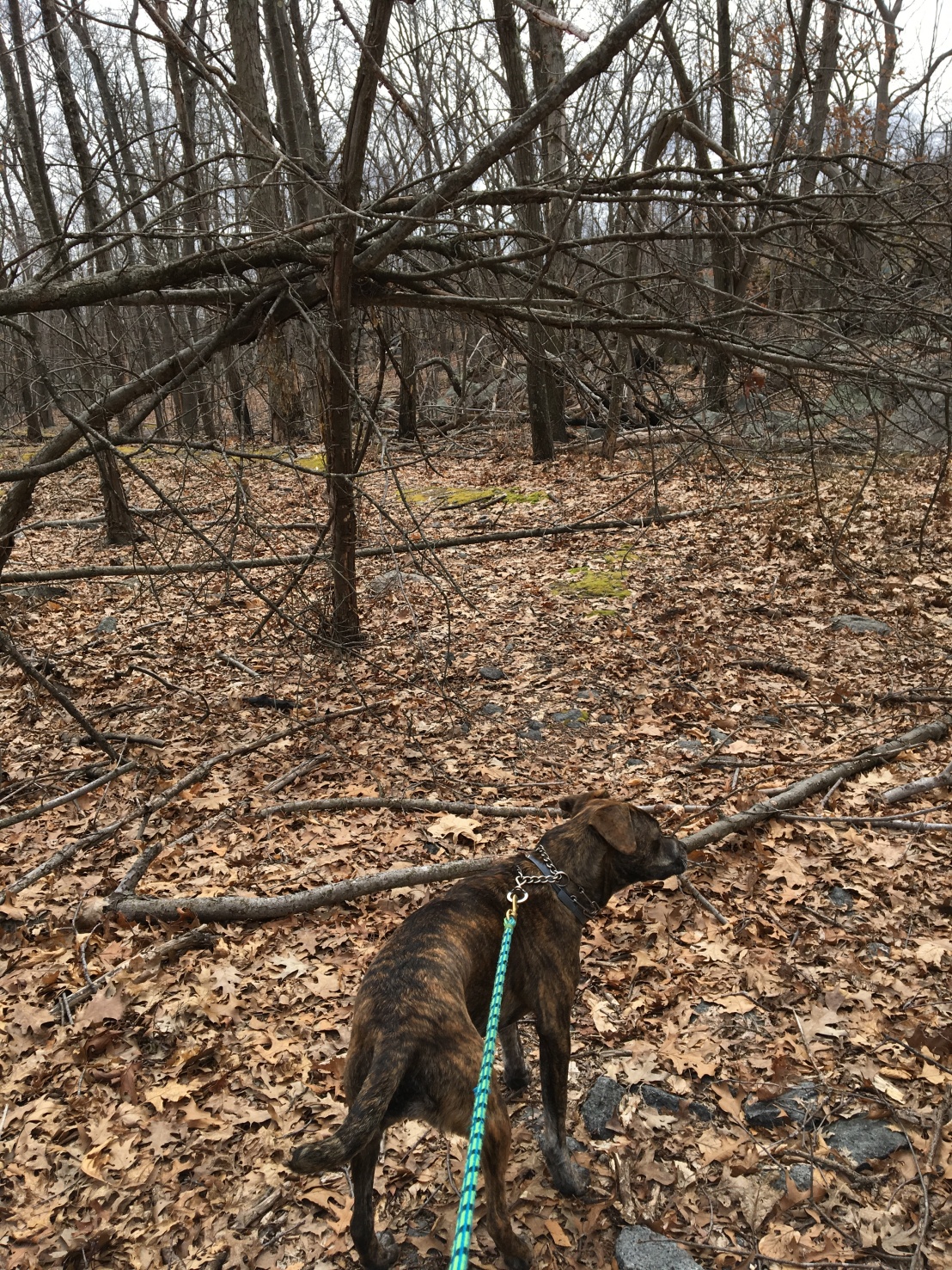
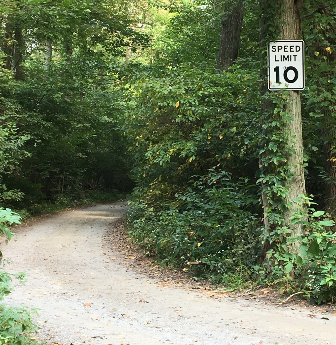
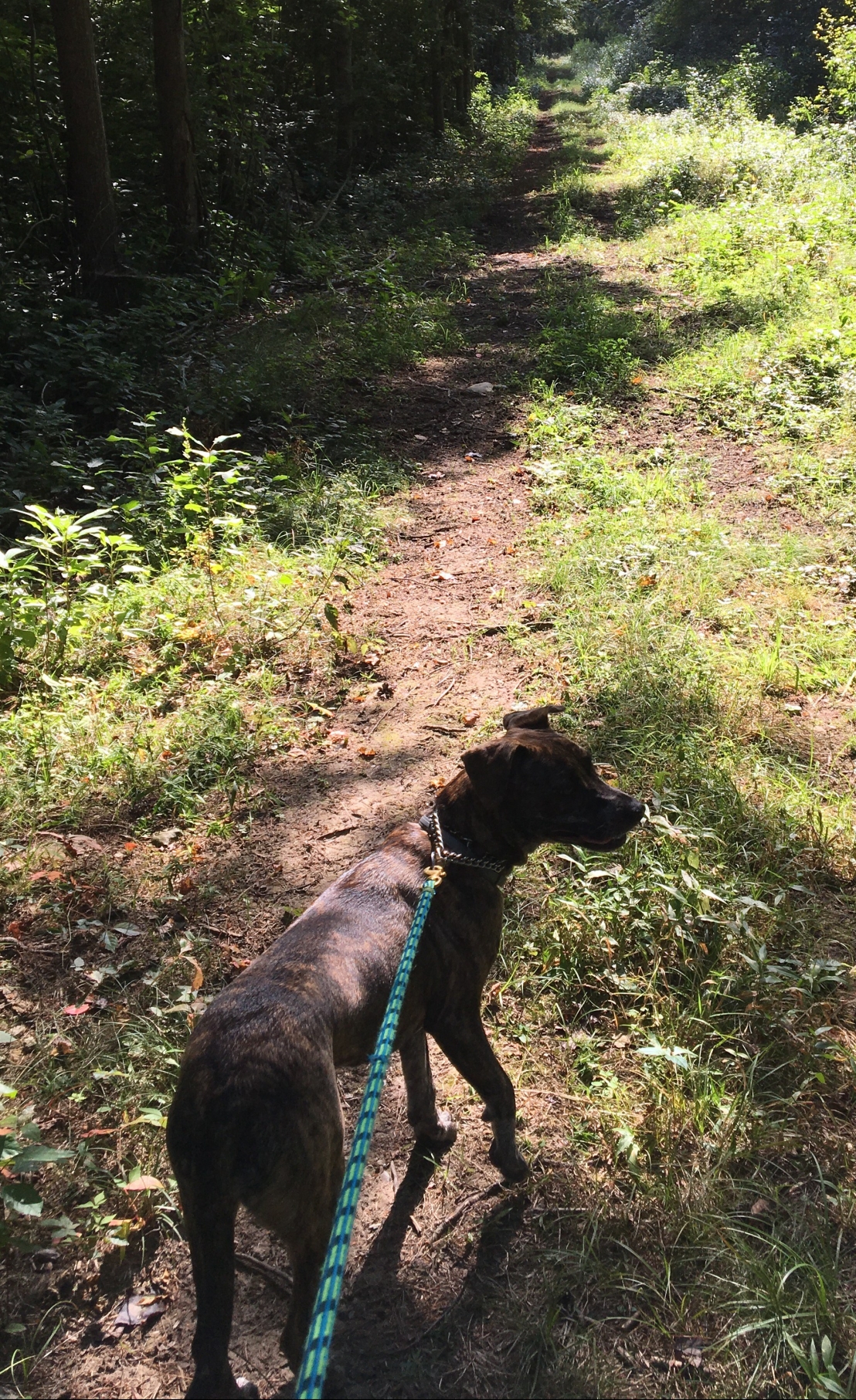
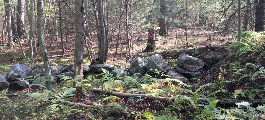
Spring finally arrived and with it one of my favorite snacks—grass! Some of the trails that wander through the woods around park headquarters have plenty of it, so I was a happy girl. On this day, we hiked all over—a little bit of the Skyline Trail, a stroll by Eliot Tower and even a portion of a Pipe Line Trail.

Bella in the tall grass
When we’re hiking in a grassy spot, I like to nibble on the blades as we pass by. Look at all of the tasty morsels behind me here!

Mom got a new job in June, so we haven’t been hiking much lately. I hope we can get back to it sometime soon. Anyone want to join us? I’m sure we’ll have more selfies to share soon!

A Brighter Side of the Blue Hills: Quincy Quarries

A Brighter Side of the Blue Hills: Quincy Quarries

This past weekend, Mom finally felt like she was kicking her head cold, so she pulled out the trail map, tempted me into the car, and decided we’d go to a little corner of the Reservation we hadn’t explored before: the Quincy Quarries Historic Site.

Trail map of the Quincy Quarries area

This place is like nothing else we’ve encountered in the Blue Hills.

It’s colorful.

Bella standing on a rock covered with graffiti

The rocks are really tall.

Quincy Quarry graffiti art

And, for some reason, people like to hang off ledges while wearing leashes.

A climber rappelling down a rock face at Quincy Quarry

After we watched the people playing on the sides of the rocks for a while, we wandered along a short boardwalk. It brought us around to the back side of the big rocks and started looking a little more like the Blue Hills I’m used to.

Bella on the boardwalk behind the Quincy Quarries

Trying to Find Wampatuck Road

We came out from behind the rocks right along the access road to the athletic fields. Mom wanted to get more miles in, so we crossed Ricciuti Drive and found the entrance to Quarries Foot Path. On the trail map, this path is a dotted line, which means it’s a narrow trail.

Quarries Foot Path on the trail map

We went off-trail so many times! With all the fallen branches and lack of foot traffic this winter, it was really hard to follow.

Quarries Foot Path

This moss-covered spot near the edge of a steep drop off was a good place to rest and get our bearings.

Bella climbing onto a moss covered hill

At one point, Mom had to pull out her phone to see where we were in relation to Wampatuck Road. Turns out, we were pretty far off track on a side trail that isn’t even on the trail map. But, she knew if we kept going in our general direction we’d end up at Sawcut Notch Path. And, that’s exactly what we did!

Sawcut Notch Path on the trail map

When we came out at Wampatuck Road, we crossed the street and tried walking clockwise around the northernmost St. Moritz Pond. No go. The trail was full of thorns and eventually stopped altogether, so we had to turn around. We did see two turtles basking on a rock, though.

Turtle basking on a rock in St. Moritz Pond

Getting onto the Green Dot Trail

We circled the southernmost part of St. Moritz Ponds and then took Murphy Path to the Pipe Line trail. (This is the green dot trail that starts at Shea Rink.) There are still some pretty big trees down on some trails. This one fell on the Pipe Line trail. But, we got around it, no problem.

Tree down on Pipe Line trail

To stay on the green dot trail, we crossed Wampatuck Road (again). This trail is called Indian Camp Trail. It is one of our favorites! You never know what you might see—like this label on a trailside tree. I wonder who put it there…

Yellowed label on an old oak tree telling us it's 135.3 years old

When it was time to head back to the car, we turned right at marker 4091 onto Crags Foot Path, where we saw this. It’s always nice to see a friendly face on the trail.

A tree stump carved to look like a face

A Different Route Home

Once we made it back to Wampatuck Road, Mom decided to take a different route back to the car. We wound our way down the sidewalk to Bunker Hill Lane and a shortcut that would take us back to Quincy Quarries. With all the maps posted at the trailhead, we didn’t have to worry about getting lost.

Maps at marker 4235 off Bunker Hill Lane

Along the way, we saw many signs of spring.


This slideshow requires JavaScript.

I wonder what we’ll see next time!

Blue Hills Lost and Found

Blue Hills Lost and Found

It seems like every time we hit the trails in the Blue Hills, we stumble across something that doesn’t quite belong there. I always wonder about the story behind the stuff we find. I usually want to bring it home with us, but Mom won’t let me. She says these things lying around make her think. Sometimes she comes up with stories about them that she tells me on the trail. Here are a few of them from a long hike we took in November.

The Not-So-Great Pumpkin

We saw this lonely, discarded pumpkin along Headquarters Path north of Chickatawbut Road on November 18.

Random pumpkin post Halloween

Wouldn’t it be awesome if a huge pumpkin patch sprung up from the seeds next fall? I can see a real-life Linus hiding behind a tree on Halloween, waiting for a glimpse of the Great Pumpkin. It’s been a long time since that animated special first aired in 1966, so I’m guessing modern-day Sally would be less likely to follow Linus into the pumpkin patch at night to see GP. She’d just wait for him to Instagram it. #GreatPumpkinWatch2018

A Tired Tube’s Final Resting Place

Every now and then, we see mountain bikers in the Blue Hills. They always look so prepared and purposeful pumping along the trail. It must have sucked when the owner of this sad-looking tire tube got a flat and had to change it out on the trail.

Left behind tire tube hanging in a tree

Perhaps he was so annoyed at having to fix the flat that he just couldn’t bear to bring the defective tube home with him. Maybe this is a warning to other mountain bikers: “Beware! This trail devours tire tubes. Turn back now!”

I’ve never repaired a flat mountain bike tire, but a quick Internet search surfaced a Wikihow 11-step tutorial while REI’s video, Cycling Tips: How to Fix a Flat Tire, tackled the topic in less than two minutes. A Yahoo!Answers user (and past bike mechanic) says it takes him just five minutes to fix a flat but could take up to a half hour for those with less experience. Whether it takes two minutes or 20, what a bummer.

There Might Be Giants

No, I’m not talking about the Grammy-winning alt-rock band of a similar name. I’m talking about this humongous wooden spool we saw just south of South Boyce Hill.

Giant wooden spool

It had obviously been there a long time. But, when you see something like this, you have to wonder why it’s there and then, of course, how in the world it came to rest right there.

I imagine Blunderbore the giant from Jack in the Beanstalk was working his antique sewing machine to make new curtains for his south-facing bedroom—to block out the afternoon sun during his daily nap. He stooped to pick up a new bobbin, bobbled it, and watched it fall to the floor and roll out the door. It rolled and rolled and eventually dropped from the clouds, unspooling the thread as it tumbled toward Earth. And, it’s lain here ever since.

One Cold Hand

Honestly, I can’t believe I haven’t done this yet: lost just one glove while winding my way through the Blue Hills. We saw this singular specimen on the southern part of the Forest Path loop as we headed back toward the parking lot on Route 28.

Abandoned glove hanging in a tree

I often wear gloves at the start of a hike only to pull them off as my body warms up and wards off the chill. I’m guessing this hiker did the same, tucking his gloves into his coat pockets without breaking stride, all with a smile on his face at the thought of going bare-handed in November. It’s so sweet that someone took the time to pick up the glove and hang it from a tree limb, hoping the owner would realize he’d dropped it, turn around, and retrieve the glove. But, I bet he never did. I imagine his name was Luke and wonder if he looks at all like Paul Newman. That would be cool.

A Post in Pictures: The Best Way to Spend a Snow Day

A Post in Pictures: The Best Way to Spend a Snow Day

The calendar may say it’s Spring, but the forecast says snow! That means more fun in the Blue Hills for Mom and me. We went walking in the Blue Hills after a snowfall in December. Here are some photos from that day. I can’t wait to do it again!

Romping in the snow is one of my favorite things to do. If the snow starts to trickle down my neck, I just give myself a good shake.

Bella shaking off some snow

I also love to sip from ice-cold puddles and pools. This one was covered in ice, but I have a strong snout and stuck it right in there.

Bella tries to take a drink from an icy pool

People seem to like taking a stroll after a snow, too.

A couple walking along Summit Road with snow stuck to the trees around them

Mom and I explored a snowy Puddle Path on our way to the top of Big Blue. I liked to hide behind the heavy branches while waiting for her.

Puddle Path under branches weighted with snow

Putting down the first paw prints of the day makes me want to run!

Bella puts down first tracks in the snow

The red dot trail didn’t look rocky with all the snow cover. But it was a little slippery!

Red dot trail marker next to the snow-covered trail

I don’t know what a detour is, but I appreciated the big sign telling us about it just south of the weather observatory.

Bella next to a detour sign south of the weather observatory

I couldn’t quite see over the bridge by Eliot Tower.

Bella on her hind legs trying to look over the edge of the bridge near Eliot Tower

A little snow on my snout is a small price to pay for being able to root around in all this fluffy stuff.

Bella with snow on her snout

Winter in the Blue Hills is so fun! It’s my new favorite time of the year to go hiking.

What is your favorite season to hike? Have you ever been hiking in wintertime?

Setting My Sights on Long Trail and Seeing Stranger Things

Setting My Sights on Long Trail and Seeing Stranger Things

Last week my family did something they’ve never done before. They left me behind overnight while they went on a little vacation in Vermont. I wasn’t upset, though. I got to make some new friends at Dogtopia! We played so hard for two whole days that I was glad to go home and get some rest on Friday when my family was back home. Before I dozed off on the couch snuggled up to Mom, she told me about the new trail she scouted for us. I’ll let Mom tell you the details.

Thank you Bill Bryson and Mother Nature

Ever since reading Bill Bryson’s book A Walk in the Woods, I have wanted to take at least a few steps of my own on the Appalachian Trail. During this year’s February vacation week, I got my chance. We had planned to ski at Stratton for a few days and were staying in Dorset, Vermont, about a 30 minute drive south. We had passed an access point for Long Trail (part of the AT) between Stratton and our rental, so I knew I had to take advantage of the opportunity if the conditions were right.

I’m no expert skier, and loose granular snow makes me feel like I’m skiing on marbles. Not a pretty sight for spectators and not so fun for me either. So, seeing that temps would be in the 70s on Wednesday was a perfect excuse for leaving the skis in the rack and taking my own walk in the woods. The plan was to trek north along Long Trail up to Bromley Mountain and back. Some signage in the parking lot showed the way for area snowmobilers.

Sign for snowmobilers at the Long Trail parking lot

My kingdom for a map

I know the AT is the granddaddy of all trails here in the east and would be a challenge far beyond what I’ve experienced in the Blue Hills, which means a map is mandatory. But, our rental house didn’t have any. Luckily a quick trip to Manchester’s busy town center remedied that. Northshire Bookstore had exactly what I needed and a whole lot more I didn’t have time to explore just then. That place was so cool inside and out. Just take a look at this mural on the loading dock door.

Mural on the loading dock door at Northshire Bookstore in Manchester, Vermont

After taking a look at the trail map, I realized that reaching the Bromley summit (and getting back to the car) before dark would be impossible even for a speedy hiker, which I am not. So, the two friends I’d roped into this adventure and I decided to dial back our destination to the Bromley shelter. It was much closer and not as steep of a climb, and I knew we could do up and back on our timeline. My taste of the trail would have to be a sip instead of a slurp.

And the river runs

Blue Hills hiking in late winter means seeing streams and waterfalls come alive with running water—a welcome sight after the dry spell last summer and fall and a hopeful sign of early spring. We saw the same kind of waterworks on a larger scale as soon as we left the parking lot and started following the white blazes onto the trail.

Telltale white blaze that marks Long Trail in Vermont

Thankfully our first water crossing didn’t involve wading. A perfectly placed I beam became a handy bridge just wide enough for crossing single-file.

Metal bridge over a brook along Long Trail

Where the Blue Hills are pretty devoid of snow right now, it’s a different story in the mountains. As we headed up our first hill, you really had to watch your step. What often looked like a heavy blanket of snow sturdy enough to walk on was really just a skim coat covering running water or mud. Luckily, other hikers had already tested the trail, so we could usually see where we should step by following others’ footprints. See the partially covered boards below? I suspect there are more of those boardwalks buried on the trail, but most of them are still covered in snow.

Snowy footing along Long Trail

Other footprints told us we were not alone in the wilderness, but we never saw any wildlife. Seeing prints that didn’t seem to be of someone’s dogs did make us think twice about continuing. But, my excitement about finally being on the AT and the balmy weather won me over, so I kept going.


A little over a mile in, I came upon Bromley Brook, which continued the wild vibe with its roaring waters and rustic one-sided bridge.

Sign for Bromley Brook

Bromley Brook bridge

There was so much water everywhere! Trickling down the path itself, jumping under a bridge crossing, or winding away alongside me at a persistent pace, I could feel winter’s grip loosening on the ground with every gallon galloping along with gravity,

A wide waterway winding along Long Trail

I was just getting into the groove after crossing Bromley Brook when, you guessed it, a water feature forced my hand. It wasn’t deep, and it wasn’t particularly treacherous, but this time the “bridge” required balance and confidence I didn’t think I had.

Steppingstones buried underwater

I don’t mind getting wet (especially on such a warm day), but the thought of wiping out midstream left me cold. If only I had brought my ski poles! But, they were lying useless in the rental. So much for that plan. I turned around, sad to give up so quickly but sure Bromley would be waiting for me when I was truly ready.

Crossing over and heading south

After reaching the parking lot, I wasn’t quite ready to go home, so I crossed Route 11—carefully but quickly given the traffic—and headed south on Long Trail for a bit.

What a different experience! Where the northbound trail across the street was well-worn and easy to see, this side showed little foot traffic. Following the white blazes took a lot of my attention to make sure I was staying on the trail. With fewer feet packing down the snow and showing me where to go around sketchy spots, I moved at a slower pace and stepped through the snow’s crust every few steps. It was annoying.

But, gosh, was it beautiful. The wind had piped up and was singing through the trees. Mossy rocks shone bright green through the snow. And, then I saw this.

A large root on Long Trail that looks like something from the Upside Down

I’ve been bingeing on Stranger Things and immediately thought Upside Down. Yikes!

Even with the otherworldly overtones, I’ll be back on the AT at some point, better prepared and excited to see what’s around each bend and over every bridge. Maybe next time, I’ll invite Eleven.


Blue Hills Hike #8: A Bridge Beyond Ponkapoag

Blue Hills Hike #8: A Bridge Beyond Ponkapoag

Time and distance: 1 hr 33 min and 4.34 miles

One thing I love about hiking with Mom is the fact that there’s something new to explore every time we’re out on the trail. You never know what’s around the bend. This time, we went back to Ponkapoag  Pond. Our plan was to find the bridge that goes over the big highway (Route 24).

If you’ve ever gone all around Ponkapoag Pond, you know that part of the main trail is actually a dirt road for cars. So you need to be extra careful. This road takes you to the Appalachian Mountain Club cabins on the east side of the pond. No speeding is allowed, which is too bad. I’m pretty fast.

Mom note: It’s so rare to see a car along this stretch of road that you shouldn’t worry about traffic. There’s a gate, and it’s locked at all times with only people who are staying at the cabins or coming in for the day can drive in.

This dirt road leads from the street to the AMC cabins on Ponkapoag Pond

The ground on the road is packed so hard it almost looks like pavement. Mom loves the look of lots of trees along a trail and likes to take pictures of them with her phone.

The dirt road that leads you to the AMC cabins on Ponkapoag Pond

It’s hard to get lost at Ponkapoag Pond because the main path is well-marked. If you’re ever wondering if you’re on the right track, look for these dots on trailside trees. If you stay on the green dot trail, you’ll go all around the pond.

Green dot trail marker on a tree near Ponkapoag Pond

My favorite part of hiking the Blue Hills is when we explore side trails like this one. It showed up as a wide path on the trail map but was actually pretty narrow. The tall reeds on the left in the sun tell me it might be a swampy walk.

Side trail off Ponkapoag dirt road

Goldenrod and cattails were mixed in with the reeds. Look at this pretty butterfly gently flapping its wings while balancing on a flower.

Butterfly on goldenrod at Ponkapoag Pond

We followed the side trail all the way to where it intersects with the Hemlock Road trail.  I could tell we were getting closer to the highway because the car noises were getting louder.

Finally, we found the bridge that would take us over the roadway full of cars! I wonder what is on the other side? And who is Charles L. Bowley?.

Mom notes: According to a 2015 article in a local newspaper, Charles L. Bowley was a dairy farmer who owned land on the other side of this horse bridge. It was built in 2010 specifically to allow horses to cross into the Blue Hills from the farm.

The horse bridge east of Ponkapoag Pond that allows horses to over Route 24 to get into the Blue Hills.

Once across the bridge, the pavement ended, and we were back in the woods. This is the view down the Pipe Line trail on the left. It’s so straight and easy to follow. I thought we were going this way, but mom wanted to meander a bit more, so we kept going to trail marker 5413.

Pipe line trail on the farm side of horse bridge near Ponkapoag Pond

We started noticing a lot of these tracks. Mom says they are from big animals that people ride called horses. I hope we get to see one!

Mom note: Evidence of horse traffic was everywhere on this side of the bridge. And, horseshoe tracks were just the start of it. Piles of horse poop at various stages of “freshness” were plentiful. Luckily, Bella didn’t seem that interested in sniffing the piles, but I had to work hard to steer her away from stepping in them.

Horseshoe tracks near Ponkapoag Pond

We’ve seen these piles of rocks all over the Blue Hills. I wonder who piled them up like that in such a straight line? I bet chipmunks or squirrels live in them. Mom says they’re actually old walls that used to separate farms.

Mom note: I find these ancient rock walls fascinating! They make me wonder what the landscape looked like back when they were built. Imagine all the hard work it took to create these walls with just manpower and animal assistance to make it happen.

Rock wall near Ponkapoag Pond

Look what we saw—a horse! I wanted to run up and say hello, but Mom thought the horse might get spooked. I couldn’t take my eyes off it and strained at my leash to get a closer look. It was so big!

Bella sees a horse on the dirt road at Ponkapoag Pond

After we saw the horse, I was thirsty, so we stopped for a drink. Mom had one, too!

Bella drinks from her fancy pink bowl

Of course, drinking from a stream is soooo much better than drinking from a bowl.

Bella drinking from a stream near Ponkapoag Pond

We had such a fun time on this hike. I saw a horse, we figured out where that bridge went, and I played in a stream. All in all, it was a very good day.

Blue Hills Hike #7: From Chickatawbut Road to 93 and Back Again

Blue Hills Hike #7: From Chickatawbut Road to 93 and Back Again

We keep coming back to Chickatawbut. But, I don’t mind. It’s a great starting spot for one of our hikes in the Blue Hills. Mom has never had a problem parking the car in the little lot on the corner of Chickatawbut Road and Route 28. And, we can go uphill or downhill or take it easy on a flat trail that goes for miles. It’s all good.

I’ve told you before that I love sticks, and this time we saw something from a dog’s dream–a carefully crafted pile of branches and logs. This was along Braintree Pass Path (a part of the red dot loop) near the intersection with Slide Notch Path.A frame of sticks along the red dot trail Braintree Pass Path

Did the branches fall that way? They’re pretty big. If not, who put them there? Why? Are they trail markers? Gathering places? Are we supposed to add one every time we pass one of these structures? They’re fascinating but confusing. Help me figure it out!

We had to follow the Pipe Line trail that runs along Route 28 for quite a while this time to get around Hawk Hill. I’ve decided that I’m not a big fan of the Pipe Line trails that pepper the Blue Hills Reservation. They get you where you need to go, but they’re not very interesting. And, every time I see one of those pipes sticking up through the ground, I wonder what’s in the pipe. Is it dangerous? Mom won’t let me close enough to find out.

A typical yellow marker along the Pipeline Paths throughout the Blue Hills.
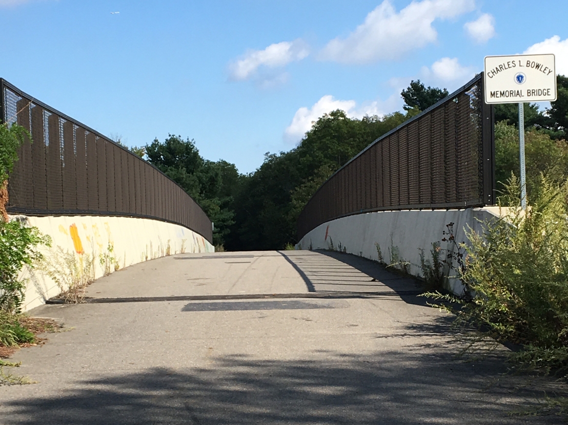
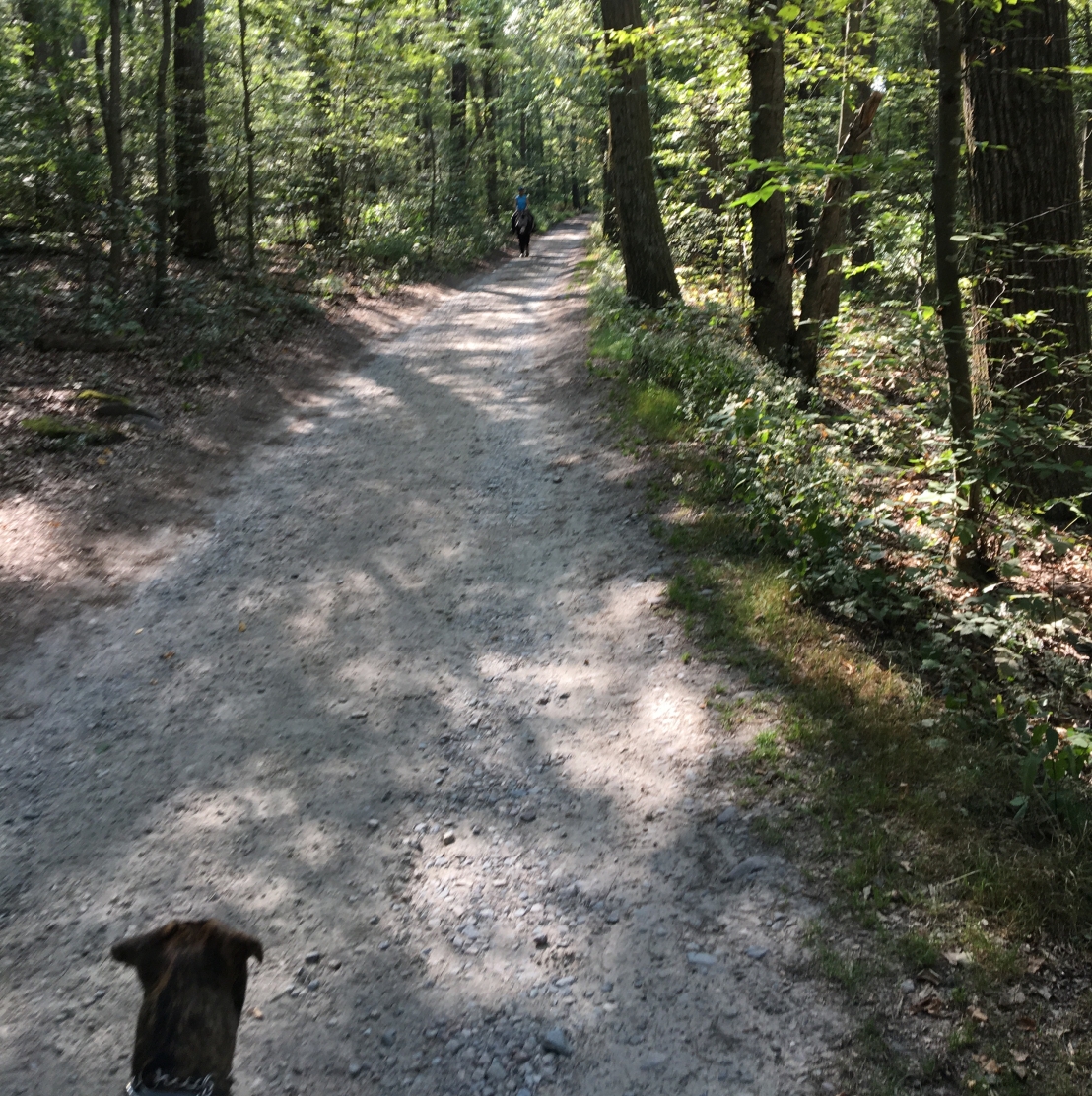
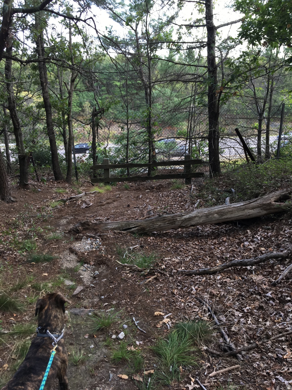
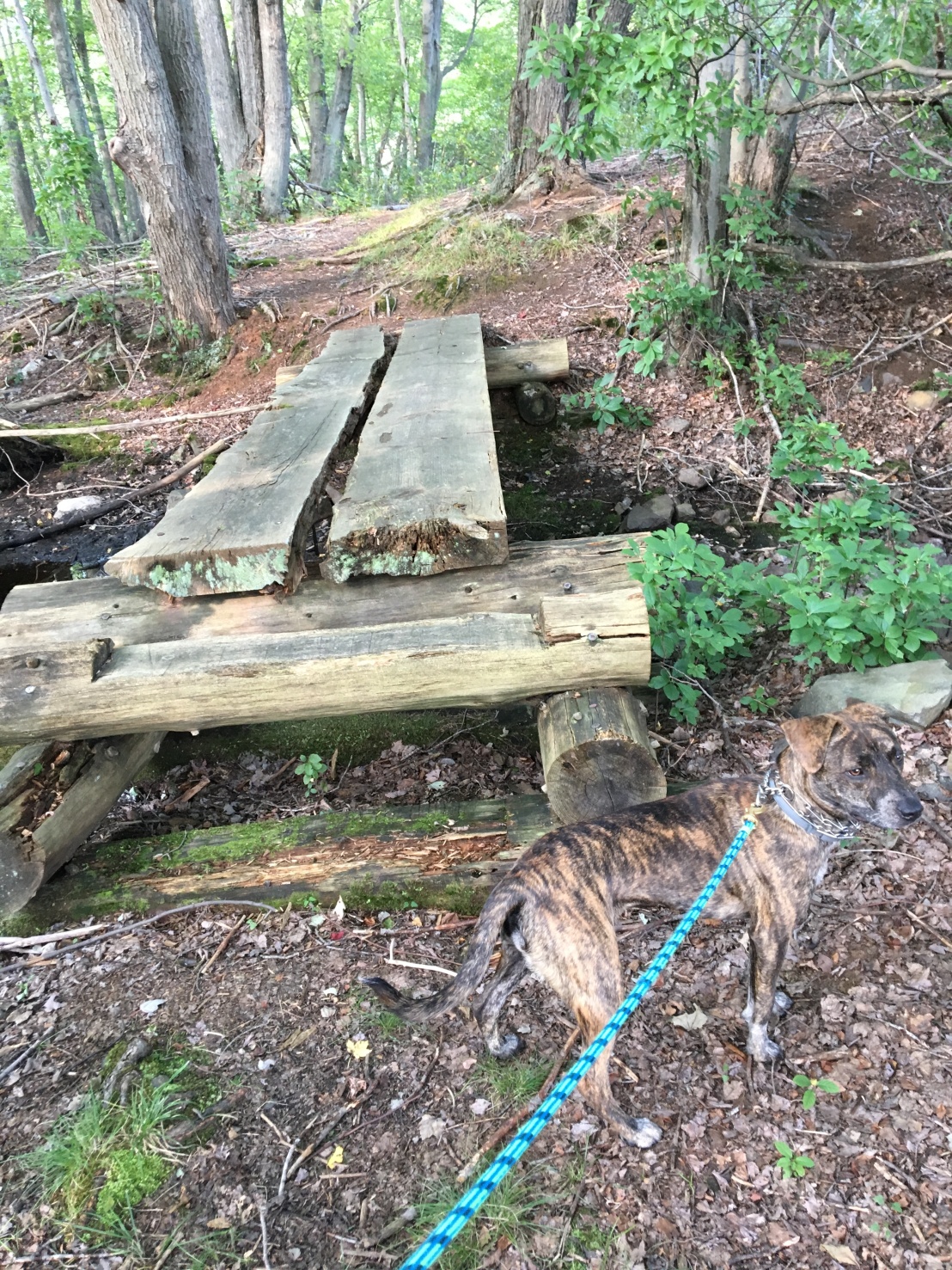
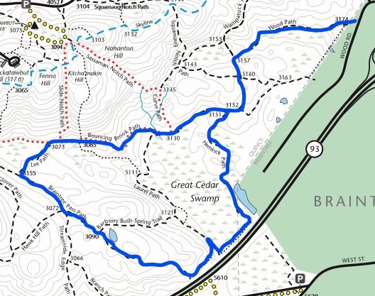
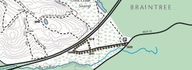
Things got more interesting–and more challenging–when we turned left onto a narrow side trail called Savoy Path. It is the total opposite of the Pipe Line trail! It switches back and forth up a hill and then hooks into Hawk Hill Path, which is a pretty straight shot down the other side. At the bottom, we turned right onto Streamside Edge Path. This was our real destination because it would take us right up to Route 93.

I really loved walking along Streamside Edge Path, although I didn’t see any streams. It has been a hot summer, so all the water seems to have dried up. Because we were hiking in mid September the trees all still had their leaves, and the grass in the middle of the path pointed the way. It’s soft on my paws and tickles my tummy, too!

Bella looks ahead at a grassy path surrounded by trees and ferns in the Blue Hills

One thing I love about hiking across hills is when the trees get all scruffy looking. Mom says they start to look like the pine trees you see on Cape Cod. (Pardon my butt in the photo below.)Scrubby looking pine trees bordering a trail that cuts across a hill

When we finally got close to the big highway (Route 93), it was clear we weren’t going to go any farther. A fence next to Route 93 at the end of Streamside Edge Path

We turned left to walk parallel to the highway for a bit until a hard left brought us back along Branch Path. We came across this nice bridge that someone made over a little stream. It was really sturdy, but we really didn’t need it. You can see the water level was really low. When it rains, it must be a real gusher and that bridge would come in handy! Wooden plank bridge crossing a stream in the Blue Hills

Next time, we’re going to figure out how to get to that bridge that crosses over Route 24. I heard there are horses!

Mom notes

We walked a total of 5.5 miles with an average pace of 22.58 per mile. A couple of things stood out from this hike.

Mountain bikers: During this hike we were actually surprised a bit by a mountain biker who came up behind us. Usually Bella turns at the slightest sound, but this time, she was engrossed in exploring the trailside and didn’t perk up. She’s my early warning system!

It’s easy to forget that you’re not out there alone because you so often are. He did the right thing, though, and announced himself with an “on your right” as he approached. I kept her close to me until he passed–I’d have hated to have him wipe out because Bella wanted to say “hi.”

Adding new trails: Does anyone know if there are plans to add trails to the Blue Hills? In looking at the trail map, there is a big area at the corner of Routes 28 and 93 that looks ripe for a path cutting from Savoy Path to Streamside Edge Path.

I do know that in November the Friends of the Blue Hills promoted an event sponsored by NEMBA to reroute a trail at Buck Hill and create another one. But I can’t find any info online about future plans. I’ll have to look into this.


Searching for a Cell Signal in the Blue Hills

Searching for a Cell Signal in the Blue Hills

Last Tuesday, Mom had promised that we’d go for a run. She is training for the Cohasset Road Race in March, which makes me happy. It gives us a reason to hit the trail. I love it when she runs because that means I get to run, too! When we just walk, I get antsy and keep trying to pull her along. She gets mad.

Then we saw this on TV, and she changed her mind.

Weather radar for Stoughton area on January 23

She said it meant rain. I don’t mind getting wet, but I guess she does. So we didn’t really go very far for very long for any reason. We were pretty much housebound.

Scouting for a signal

Wednesday was a different story. We were going to scout some locations in the Blue Hills Reservation for our big video debut on Thursday. Mom said we needed a place that has a strong, reliable cell phone signal, and she still hadn’t gotten to her training run. So we had two reasons to get out there.

We were going to do something called Facebook Live with Friends of the Blue Hills as part of their weekly video show. Mom has been helping behind the camera for the past few weeks, and now it was our turn to be in front of the camera. Our topic was walking your dog in the Blue Hills. It’s posted now, so you can watch it by clicking on the image below.

Dogs in the Blue Hills video with Friends of the Blue Hills

Here are the places we visited while searching for a signal. If you guys know of any spots in the Blue Hills that have a strong cell signal, let me know. Mom wants to do another live video of one of our hikes!

Ponkapoag Pond

Ponkapoag is one of my favorite places to go in the Blue Hills. When it was warmer, I could splash around chasing fish!

A windy day at Ponkapoag Pond with Bella splashing on the shore.

It’s close to where we live, and there are lots of places to park your car. We usually park in the small lot off Randolph Street where people can bring their boats and launch them into the pond. There isn’t much boat traffic in the wintertime, so we can usually find a spot no problem!

We parked in the Randolph Street lot and walked down to the edge of the pond. I wanted to explore the ice, but Mom said no. I don’t think many boats have launched here lately. But, it does look like people might have been skating when the ice was safe.

Boat launch area at Ponkapoag Pond in winter

After checking out the beautiful view across the pond, we turned back toward the main trail and followed it toward the golf course. It was a little muddy, but that’s never bothers me. I saw Mom jump over a couple of puddles to keep her sneakers from getting wet and muddy. I didn’t know she had it in her!

As we worked our way around the pond, Mom kept checking the signal on her phone. The only place that had at least three bars was right along the pond on Acton Path where it gets marshy on the left. This is the view looking back along the path. The boat launch area is right back there around the corner.

Acton Path at Ponkapoag Pond in winter

I found a couple tasty sticks along the way and ran with them for a while. Then I hit Mom in the leg with one accidentally, and she made me drop it.

Cell signal: Anywhere from one to three bars all the way around the pond. Only one bar right next to the golf course.

Route 128 Entrance to Ponkapoag

Mom wanted to check out the other side of Ponkapoag, so we hopped in the car and headed toward the highway. There wasn’t much traffic (it was the middle of the day) so we got to the Ponkapoag exit quickly. A lot of cars were parked at the entrance, so we couldn’t stay long and didn’t even get out of the car. So I curled up for a nap.

Bella curling up in the car

Cell signal: Not good. Just one bar in the parking area.

Chickatawbut Road and Route 28

Mom was in a hurry to get home, so we didn’t get to even stop the car along Chickatawbut Road. But, she did say there appeared to be a pretty good signal. There is a side trail that winds right along with the road, so that looks promising as long as the road noise isn’t too loud.

Cell signal: Four bars between Forest Street and Route 28 and then all along Route 28 heading toward the 95 on ramp. If you don’t mind road noise in the background, this location might work.

Mom Notes

Only after all my scouting did I realize that signal strength is just part of the story when determining if a location is a good spot for streaming. You also need to consider upload speed (duh, right?).

I found a free, highly rated app in the App Store, so when I go hiking next time, I’ll be checking upload speeds as well as general connectivity–we need a map that shows where the strong signals are! Watch for a post that shows my progress in developing one.

Screenshot of SpeedSmart Speed Test app


A Boat Dog Is Born!

A Boat Dog Is Born!

It’s another cold day in Massachusetts. So cold that Mom doesn’t want to go hiking and would prefer if we didn’t have to go outside at all. She says this chill makes her want to revisit summertime. So let me tell you about my first time on a sailboat!

Mom and Dad have some friends who let them borrow a sailboat called a J105. It’s name is Got Qi and it’s about 35 feet long. One day Mom and Dad decided to go for a day sail on the boat and brought me along. I’d never been on a sailboat before but like trying new things, so I hopped in the car and off we went.

We had to ride in a little powerboat called a launch to get to Got Qi, and it was loud. But the ride was quick, and soon Dad was lifting me out of the little boat and onto the sailboat.

At first I didn’t know what to think and looked to Mom for a little help figuring it out.

Bella looking to Mom for help figuring out where she and what's going on

You’ll notice I’m wearing a life jacket now, something I’ve never heard of before. Mom says I have to wear it when I’m on a boat, but I don’t see why. It feels weird, and I swear other dogs are laughing at me. I can’t seem to wriggle out of it no matter how hard I try. I think it’s clipped around my middle. Dad used the handle on top to lift me out of the launch and onto Got Qi, but I could have jumped right onto the deck. I know it. There has got to be a way to get this thing off.

We did see lots of interesting stuff on the water. Other boats, some fast and some slow. Some with engines and some with sails. There were islands everywhere. I hope we get to go to one next time.

We got pretty close to this thing sitting in the water, but I don’t know what it is. Do you?Bella looking at a green gong #11 in Hingham Bay

I made Mom nervous because I liked to stand right on the edge of the deck. She kept thinking I would fall off. She really has to have more faith in me. I have excellent balance.

There wasn’t much to do on the boat except look around. So I paced back and forth from the front to the back. I don’t know why there were ropes lying on the deck, but I had to pay attention whenever Mom or Dad pulled on one. I got tangled once and they both freaked out.

Bella pacing the deck of the J105 Got Qi

Eventually I felt sleepy and laid down next to Mom in the cockpit.

Bella relaxing in the cockpit of the J105

Dad kept looking up at the sail as he was driving the boat. And once in a while he’d pull on that rope in his hand. I really wanted to chew on that rope, but I knew I’d never get away with it. It smelled so salty and delicious.

It was a fun day trying something new. I liked to watch the other boats buzz by. Some of them went really fast!

Bella heading into Hingham Bay after a day of sailing on the J105 Got Qi

I’m sure I’ll be boating again when it gets warmer. Hopefully I won’t have to wear that life jacket next time!

Making the most of bad weather and an abbreviated body part

Making the most of bad weather and an abbreviated body part

Remember when Glen Echo Lake looked like this?

A windy day at Glen Echo Lake

And not this.

Glen Echo Lake in winter with Bella in the foreground

Remember when I would come running, tail wagging, whenever we were out hiking?

Bella approaching with tail wagging

OK, well I still do that, but there’s a little less of me wagging.

Bella's tail bandage

The vet had to cut off part of my tail because there was a nasty bump on it that kept bleeding. Now that the bump is gone I have to wear a bandage on what’s left of my tail. Every once in a while, I try to nibble on it (it itches!) but Mom says that’s bad and makes me wear this until I stop trying.

Bella in the cone of shame

I also can’t get my stub wet or I’ll be in big trouble. So, our Blue Hills hiking is on hiatus until I heal. Stitches come out on January 12!

Stay tune for some fall flashbacks

Mom has a bunch of posts from earlier this fall that she’s hoping to get out there soon. We’ll call them flashbacks to fall hiking until we can get back to the hills this winter.

You’ll also notice that our deadline for our Skyline Trail adventure has been postponed. Given how cold it’s been around here, that’s probably for the best. Mom makes me wear a jacket when it’s below freezing, and I hate it.

Bella in her teal fleece jacket romping in the snow

So long for now, and stay warm my friends!

Blue Hills Hike #6: The Long Way Around Great Cedar Swamp

Blue Hills Hike #6: The Long Way Around Great Cedar Swamp

Remember when Mom, Haley and I hiked a teeny part of the Blue Hills Reservation off West Street in Braintree? If not, read about it here. Well, Mom is almost as stubborn as I am, and she was determined to get to the part of the trail she thought we could get to by going under (over?) Route 24. So, that’s where we went on this afternoon in September. It ended up being about 5 miles total.

Parking and Praying on Wood Road

The trail map told us we should enter the Res at sign 3174 on Wood Road to get to Great Cedar Swamp. Unlike the huge parking lot near Little Blue Hill on Route 28, there was no lot at all on Wood Road near the trail entrance. None. But Mom is a tricky one and squeezed in between the road and a fence with the Highlander. She said she prayed we don’t get towed. Does anyone know what that means?

Being part of a hockey family means that we know Wood Road well. It’s where a store called Pure Hockey is. That’s where Mom goes almost every year to buy new equipment for my sister Haley or my brother Cameron. They use these long sticks to hit a little black cookie all over the ice. I don’t know why. But, I do know I’ve tasted one of those cookies before, and they are delicious. We have a pond near our house, and I’m hoping they take me out there when it’s icy so I can play hockey, too! I can totally carry one of those sticks in my mouth.

Summer view of skating pond near Glen Echo Lake
This is the small pond near my house where my family plays hockey when it’s cold. It looks a lot different in the summer. That bench must be where they put on those weird shoes called skates.

Back to Bouncing Brook Path

There weren’t many hills on this hike. But we did go all the way around Great Cedar Swamp. We started out on Wood Path and were all alone hiking the often grassy trail until we turned left at sign 3157. Mom jumped about a mile when another hiker seemed to come out of nowhere behind us. That will teach her to wear those wired plugs in her ears while hiking!

I remembered Bouncing Brook Path because we’d been on it before—and Mom recognized the telltale red dots that mark the trail.

Red dot trail markers in the Blue Hills Reservation
These dots can tell you where you are and what to expect on the trail up ahead—a rocky road!

A Long Walk on Braintree Pass Path

We had passed by the turn onto Lee Path at marker 3073 the last time we were hiking Bouncing Brook Path. This time we turned onto this winding but short trail that would take us to Braintree Pass Path. It would help us close the loop around Great Cedar Swamp.

Braintree Pass Path toward Route 93
You can see the grassy part of the path that Bella loves to munch on so much. The trees along part of this path reminded Mom of scrub pines from the Cape.

Braintree Pass Path was really long and pretty straight with a lot of sunny spots toward the end of it. It was an easy walk for me, but I was on high alert. I kept hearing strange animals making louder and louder growling noises. And there seemed to be a lot of them! But I couldn’t see anything. At the end of Braintree Pass Path, I finally could see what was so noisy—many many cars moving really fast! To finish our hike and get back to the car, we had to get even closer to them by turning left onto a narrow, unnamed side trail. It took us right next to the paved path called Route 93 where all those cars were chasing each other. I confess it made me nervous, but Mom didn’t seem worried at all. Maybe because there was a fence between us and the cars.

Finally! Great Cedar Swamp

Turning left onto Hemlock Path and away from Route 93 gave us a good view of Great Cedar Swamp. But, honestly, it didn’t look very wet to me. Mom says we’ve had a really dry summer with little rain, so that must be why. As we were walking through the more wooded parts of the trail, you could see areas that must have been wet at one time. There were lots of plants that looked like bird feathers and cushions of something called moss that looked like it would feel soft on my paws. You could see where the water must run after a rain. And, it smelled sooooo good. Like layers and layers of old smelly things piled on top of each other. If I had been off leash, I would have been jowls deep in it.

Mom Notes

As you can tell, there aren’t that many photos with this post. That’s my bad. Sometimes I’m just enjoying the hike so much that I forget to document some of what I find most interesting along the way. Sometimes my phone dies. And sometimes managing Bella is a full-time job—that girl is so curious about everything she sees. And smells. And touches. And hears.

Later posts have a lot more photos so I think I’ll do some that are purely pictures with short captions. Being new at this blogging thing means I learn as I go. I hope you stick around for the ride!

Blue Hills Hike #5: Forest Path, Dark Hollow, and North and South Boyce Hills

Blue Hills Hike #5: Forest Path, Dark Hollow, and North and South Boyce Hills

We’re starting to take longer hikes—and, I love it! This one took us along Forest Path from a tiny parking lot on Route 28. This hike was pretty popular with people; we saw small groups and a few dogs going both ways. It was a sunny day but nice and shady under the trees. I guess that’s why the trail is called Forest Path! The grass in the middle of parts of the trail felt good between my toes as we walked along. (And it tasted good, too.) As you can see below, Forest Path is mostly straight and flat. I felt like I could hike forever even though it was a warm midday in early September!

Forest Path
Forest Path is rocky and smooth at the same time thanks to the grassy part in the middle. Mom said it makes her think of horse-drawn carriages.

At intersection 2153, we went straight and winded our way between North Boyce and South Boyce Hills. The path between them was beautiful. Very grassy and bright. Sunny and serene. I couldn’t help but zigzag from side to side to take in all the scenery. Maybe we’ll go back someday, and we can show you what it looked like.

We curved right onto a Red Dot trail for a bit (I love how rocky it was!) and took a hard right to get to Dark Hollow. Dark Hollow is a Green Dot trail, so it’s pretty easy and not nearly as rocky as the Red Dot trail. There were fewer people on this trail. When we could see Chickatawbut Road at sign 2112, we turned right to get back onto Forest Path and back to the car.

Bridge over part of Forest Path
What’s that up ahead? It looks like a bridge, and that means water! Good thing I’m not a horse, though. The sign says they’re not allowed.

Not long after getting back onto Forest Path, we came across some wetlands (you can see the special symbols on the trail map above). I know that wet means water, so I’m hoping there will be some swimming in my future! And, there it is. A bridge. That definitely means we’ll be going over water.

Sadly, the wetlands weren’t very wet. Even so, Mom made me stay on the bridge instead of investigating around it. So much for playing in the mud!

NEMBA FBH bridge on Forest Path near Chickatawbut Road
I don’t care what NEMBA FBH means. I want to find out what’s under this bridge!

The rest of our walk along Forest Path was uneventful. After 3.84 miles, I was ready to curl up in the backseat of the Highlander anyway. I knew Mom would take me home and give me lunch—I earned it!

Mom Notes

Being a Blue Hills newbie, I had no idea what NEMBA FBH meant on that bridge we crossed on Forest Path. Once we got home, I asked the Internet (naturally) and learned that NEMBA stands for New England Mountain Bike Association and FBH is, of course, short for Friends of the Blue Hills. 

The bridge you see above looks like a trail project sponsored by NEMBA. Does anyone know if this is true? If you know of a trail (even outside the Blue Hills) that needs some TLC, you can apply for a grant from NEMBA to help make it happen. During the wet season, I’m sure this bridge is indispensable. Otherwise, this part of the trail would be impassable for all but those who are willing to wade through water to get to the other side. Bella would be all over that; me, not so much. Even when the wetlands are dry, the bridge makes for a pretty picture and change of pace from the rocky ground. Thank you NEMBA and FBH!

Blue Hills Hike #4: Little Blue Hill and Our First Taste of the Skyline Trail

Blue Hills Hike #4: Little Blue Hill and Our First Taste of the Skyline Trail

We did it! Mom and I hiked our first section of the Skyline Trail today.

Mom parked the Highlander in a really large lot off Route 138. A few people were sitting in their cars eating their lunch or looking at their phones, but the lot was pretty empty. I wonder if those people were getting ready to go hiking or had just finished. They didn’t look tired and sweaty. They must have been getting ready. I didn’t see any other dogs.

Now I know when I see a Blue Hills Reservation sign, we’re in the right place. I had never noticed this sign before because it’s so far from the main road. Mom thought the lot was just for commuters!

Blue Hills Reservation sign
It’s unusual to see one of these signs with no flyers, posters, or other information tacked up. But you can see a couple of the cars in the lot reflected in the glass.

We were confused at first when we entered the Res. There were a lot of side trails crisscrossing all over the place, and they weren’t on the trail map. We’ve learned that while the trail map is a good guide, you’ll sometimes see trails in real life that aren’t on it. Eventually Mom decided we should bear left to get to the Skyline Trail. So that’s what we did. We quickly realized we were heading in the right direction. Markings on the trees gave it away. Did someone put those marks there on purpose? If so, thank you!

Skyline Trail tree markers
These markings helped tell us where to go—and where we were!

I was surprised that the Skyline Trail wasn’t closer to the sky. We were under the trees and not seeing a whole lot of sky through the leaves. But, all of a sudden the going got steep. The map told us we were heading up Little Blue Hill. My claws are really good for digging and tracking through soft dirt and pine needles. They aren’t so good for clambering up rocks. Mom had to give me a push to get me up over one part of the rocky trail. I couldn’t quite make the jump. We met a man coming down Little Blue Hill as we were going up. I knew if he could do it, so could we!

Map of westernmost section of Skyline Trail
You can see the really steep part of our climb up Little Blue Hill on the trail map. Mom says you can tell it’s steep because the contour lines are very close together. On the other side of Little Blue Hill, the trail flattens out. You can tell because the contour lines on the map are far apart.

One of my favorite parts of this hike was when we walked along part of the path that cuts into the side of the hill (between 6700 and 6600 on the map above). When I looked left, I could see cars rolling along on a street right next to us (Royall Street). But I don’t think any of the drivers even knew we were there! When I looked right, I had to tilt my head up so I could see beyond the top of the rise.

Mom gets nervous when I get near a road, so we were extra careful crossing over the pavement at 6600. Turning back, we could see the trailhead marker telling us we were indeed on the Skyline Trail!

Skyline Trail marker
You can see the trail we had come from to the left of this marker.

The rest of this hike was easy. There were no more hills, so I strolled along, sniffing the ground, listening to the muffled traffic sounds, and looking for anything interesting to nibble on. When we came to the end of the Skyline Trail, it literally just stopped. There wasn’t a sign. There wasn’t a building. There wasn’t anything other than the wilderness around us.

We ended up backtracking to Cosmos Path and looping around to the left of Little Blue Hill to get back to the parking lot. I’d like to go back and wander some of those side trails. You never know what you might find!

Mom Notes

This was a great introduction to the Skyline Trail because it had just that one steep climb that was super short, followed by what really amounted to a walk in the woods for a total of 2.78 miles. (BTW A Walk in the Woods by Bill Bryson is a great book about his experience hiking the Appalachian Trail. It is literally laugh-out-loud funny in places, and I highly recommend it. I think there’s even a movie about it now.)

I will say that I was expecting more from the terminus of the Skyline Trail. If I hadn’t done this portion of the trail before we do our big hike from end to end, I would have been disappointed. Give me at least a trailhead marker I can take a selfie with!

Or, it’s totally possible that this end is supposed to be the starting point, and I’m approaching it ass backwards. Wouldn’t be the first time…

Blue Hills Hike #3: West Street, Braintree

Blue Hills Hike #3: West Street, Braintree

I couldn’t believe it when Haley said she’d go on another hike with Mom and me. After the mile-a-minute weeds we found at Fowl Meadow, I was sure we’d never see her again on the trail. I heard Mom promise this time there wouldn’t be any weeds and we’d stick to a shorter distance. I could live without those weeds, but I like it when we go a long ways. Maybe next time!

This trail was so different from the last one at Fowl Meadow. It was really short, and had just one side trail (those are usually my favorite). For some reason, Mom thought we could go over a busy road called Route 24 and continue on the other side (see that dashed line off the parking lot in the picture below). But, we couldn’t. We did turn left onto a much narrower trail, but we had to give up and turn back once the trail got into some tall reeds and squishy ground. I couldn’t see my way forward, and Haley refused to go on into the wet, so back we went.

Blue Hills trail map--West Street, Braintree
Yellow dot trails are perfect when you have little time or young kids. They’re short and flat but still fun.

(Mom note: I don’t know what made me think we could connect with the trails on the other side of 24. The dashed trail on the right just lined up too perfectly with the one on the other side of the highway, I guess. Lesson learned!)

Every trail hike is different—and sometimes we see something unexpected but wonderful! When we do, mom tries to take a photo. And, I definitely have to go in for a sniff. Unless Haley stops me, that is. I can’t tell if she’s pushing me away from that big mushroom or if she’s comparing her hand to the size of that thing!

West Street Braintree mushroom
This has got to be the biggest mushroom I’ve ever seen! (Sorry for the slightly blurry image–it started out as a video.)

This is the first trail we’ve been on that is mostly paved. That makes it easy to walk on but doesn’t feel as good on my feet. At first, I wondered why there were no cars. Then I realized how close we were to the highway. The cars were going by really fast. You could hear the engine noise like a constant hum. But, a fence along part of the trail at the end of the pavement kept us far enough away from the action. I felt safe.

West Street, Braintree
At the end of the paved part is a loop that takes you off to the right and back through the woods. That part is more like a typical Blue Hills trail. It is a bit rocky and kind of winding. You can hear the highway noise and see the cars through gaps in the trees.

I know we have lots more trails to explore in the Blue Hills, but it was fun to find this little gem in Braintree!

Mom Notes

At first I was disappointed that the trail was so short, but in hindsight (and after hiking a lot more of the Blue Hills) I realized that what’s wonderful about the Blue Hills is the fact that there is truly a trail for everyone. I could imagine workers taking a quick walk at lunch here or a mom with a sleepy toddler strolling along in peace.

I’m also a sucker for a trail with arching tree branches that almost touch overhead. And, this trail didn’t disappoint. Looking up and seeing those full branches partially obscuring the sky and then looking down to see the cracked pavement slowly falling back to nature felt so yin and yang. I came away smiling. And, that’s what the Blue Hills is all about.

Blue Hills Hike #2: Fowl Meadow

Blue Hills Hike #2: Fowl Meadow

The empty parking lot should have been a sign. But, Mom figured that just meant the trails would be wide open without a lot of other people getting in our way. She was enthusiastic to hit the trail, and so was I. The trail map looked pretty straightforward, and Mom could tell it wouldn’t be too hilly.

blue hills trail map 2016 fowl meadow
If you never looked at a Blue Hills trail map, you’d probably never know that these trails are even part of the Reservation!

I was so happy to start this hike because my sister Haley had decided to come with us. She is one of my favorite people! She led the way along Burma Road and turned us right onto Fowl Meadow Path until we got to the river. It was a good place to take a break and have a drink.

Haley and Bella next to the Neponset River
It was a hot day, and the water looked cool, but it was really muddy and didn’t taste good. Good thing Mom always brings water for us!

Right after I cooled off a bit in the river, we turned left onto a really narrow trail that winds along the water. At first we walked under the trees, picking our way slowly forward because it was such a curvy path. After a while, the trail became kind of covered up by a really pretty plant with leaves that look like triangles. As we kept going, there was more and more of it—it was everywhere! It had pointy things on it that seemed to scratch Mom and Haley quite a bit on the legs but didn’t really bother me. Thank you fur!

[Normally you’d see a photo of that pretty plant here, but Mom was so busy pushing through it she didn’t pull out her camera. Mom says you’ll just have to Google it to see what we dealt with.]

I thought we would turn around and go back the way we came. But, Mom can be stubborn and said we would keep going, thinking it would get better up ahead. It never did. It got worse. Even with my nose to the ground, I kept losing the trail. I couldn’t see through the vines! I was so embarrassed, but Mom encouraged me to keep moving forward. I was really glad when that part of the hike was over and we got back onto the main trail.

By that time, we were all hot and tired and ready to go home. But, we were still a long way away from the car, and there was only one way to get there. Keep walking. So that’s what we did. Together.

img_0716-e1505782473828.jpg
Haley and I took the lead heading back on Burma Road. Can you see how long and straight this trail is? Did I mention how long it is?

Mom notes

  • This hike ended up being a little over 5 miles total, which might have been a little much for us on such a hot day (it was in the mid 80s). We went through all our water and probably could have used another bottle. Next time, we’ll be sure to take temperature into account when we hit the trail!
  • Once I got home I looked up that vine that had pretty much taken over part of the riverside trail. It has several names but may be most widely known as mile-a-minute weed. It’s an invasive (boo!) that was accidentally brought to the U.S. from Asia. If you come across it, environmental authorities want to know. This form shows you what it looks like and provides contact info.
  • Would I do this trail again? Maybe. I’m not a big fan of the long, straight, and flat, and there is no way I will traipse again through that tangled mess of weeds. There are some side trails in this part of the Blue Hills that are on my list, though, so I’ll be back exploring the less scratchy side of the Reservation.
Four Lessons I’ve Learned from the Trail

Four Lessons I’ve Learned from the Trail

Mom and I have been at this hiking thing for a while now, and there are a few things I’ve learned along the way:

1. Mud feels good between my toes. Not so much on my snout.

Bella in the mud

When I saw Glen Echo Lake for the first time, I didn’t want to get my feet wet, much less swim. Now I love the water! And, if I have to walk through mud to get to it, all the better.

2. Water from a stream is way better than water from a bowl.

Bella drinking from a stream

Mom always brings a bowl on our hikes so I can have a drink every couple of miles. It’s a good thing she does because there doesn’t seem to be much running water where we hike. Every once in a while I get lucky and we pass over a stream. The water smells so good and is so cold that I just have to lap it up. It is delicious!

3. No stick is too big if you put your mind—and mouth—to it.

Bella with a big stick

Sticks are my favorite. Big, little, smooth, or rough, I like to pick them up in my mouth and give them a taste. Sometimes, they are so delicious I eat them. Mom doesn’t seem to like that. Finding a great, big branch like the one you see here makes me so happy, I don’t want to let it go. I usually carry it around for a little while until I get too tired. I know it will be waiting for me the next time we hit the trail. Ever since Mom found splinters all over the living room rug, she won’t let me bring them in the house anymore.

4. When Mom talks, I’d better listen.

Bella listening

When Mom says certain words, I perk up my ears and pay attention. If I don’t, she gets a “tone” in her voice that tells me she means business. Does your Mom or Dad do the same thing? Here’s what I think she means when she’s talking. But sometimes I’m not sure. I wish she spoke Dog.

Wait. This means stop where I am until she’s ready to go on. I have a hard time with this one if I see a squirrel. I hate those things.

Let’s go. She says this a lot when I stop too long to sniff a rock or branch or leaf or piece of trash. I can usually count on a quick tug of my leash to tell me it’s time to move.

Easy. This almost always comes with a quick pull on my leash. It means I need to slow down.

Come on. This is kind of like “let’s go” but usually comes out when I’m lagging behind. Doesn’t she know that I’ve found something interested and need to check it out? I guess not.

Do you want a drink? This means we’re going to stop and have some water. Sometimes I can’t wait until she pours it into the bowl—I slurp it up as it comes out of the bottle. I like it when she tips the bowl up for me so I can get to the water a lot easier.

Leave it. She taught me this one way before we ever started hiking. No matter how deliciously smelly or interesting looking something is on the ground I am not to pick it up in my mouth. If I “leave it” I might get a cookie!

Car. When we get in the “car” I know we’re going somewhere fun. It could be to Petco for a new toy, to the Blue Hills for a hike, or to pick up my sister from school. I absolutely love riding in the car and will hop right into the backseat when I hear that word. Remind me to tell you about the time I escaped from the car at school! Mom was mad, but I had the best time!

Good girl. This is my favorite thing to hear my mom say. It means I’ve done something to make her happy (even though I often don’t know what I’ve done). Head scratches and cookies are sure to follow!

Mom Notes

What have I learned? Here’s a quick list that I’m sure will get longer over time:

  1. Be wary of off-leash dogs. Just because people say their dogs are friendly doesn’t mean they are.
  2. Don’t be afraid of rocky terrain or slopes. I can’t believe how well Bella takes to the trail, no matter what the footing is like.
  3. Get some hiking shoes! I’ve been hiking in sneakers and can feel every rock and root on the trail. I need something sturdier before we tackle the Skyline Trail!
  4. Ditch the ear buds. I used to listen to podcasts when hiking with Bella, but once I was surprised from behind by another hiker, I stopped wearing them. In all honesty, my brain seems to enjoy the down time from electronics, and I think I’m appreciating nature’s beauty more.


Blue Hills Hike #1: Chickatawbut Tower

Blue Hills Hike #1: Chickatawbut Tower

When Mom told me we were going to a place called Chickatawbut, I was hoping there would be chickens. I’m so good at running off the ducks that hang out in the brook behind my house that chickens shouldn’t be much trouble at all. After all, they can’t even fly away! Sadly, there were no chickens. But I did get to ride in the car (yay!) and go for a nice long walk in a big circle with Mom.

We parked at a place called Chickatawbut Overlook. There were a lot of cars in the lot—that means people and dogs! We had to cross the street to head up some stone steps to get to the tower, but it didn’t take long. I could see a whole bunch of buildings in the distance. Maybe we’ll hike there someday. At the tower, we went down a small hill into the woods. Then we had a choice of right or left, and Mom realized she didn’t have the trail map with her!

View from Chickatawbut Hill
Boston looked so close from the stairs to Chickatawbut Tower.

Because we didn’t have a map, Mom figured we should just try to do a loop. She could track our progress on her phone. I don’t have a phone, but I bet I could have retraced our steps with my nose.

Chickatawbut Tower
After this hike, Mom downloaded the trail map to her phone so we could see where we’d been. Now we’ll never get lost!

We took a right at the next fork in the path, down Slide Notch Path. It was steep, narrow, and rocky. We had to slow down to keep our footing. It took us a long time to get to the bottom. When we did, we took another left onto Bouncing Brook Path. It was a much flatter trail. I kept looking for a brook like we have at home, but there was no water anywhere. Where did it go?

We met two big, white dogs when we turned left onto Curve Path. Those lucky dogs weren’t even on leashes! I think they wanted to say “hi” to me, but I hid behind Mom’s leg. Big dogs make me nervous. Their Mom and Dad both had long sticks they were holding when they walked. Do you think Mom would get me one? Sticks are my favorite. They taste good.

One more left brought us back to the short trail we had to take to get back to the tower. Then we walked back down the stone steps to the car. I napped on the way home but will be ready the next time Mom says, “All aboard for the Blue Hills!”

Mom Notes

The Map My Run app came in really handy for this hike. I used it to not only track our distance but also gauge when we might want to start heading back (or at least start closing the circle!). I liked how it called out the time and distance every mile. I never stopped to think that I could go on the Blue Hills website and download the map until after we were done. D’oh!

May My Run report for Chickatawbut Tower
I would love it if the Map My Run workout summary showed elevation gain/loss somehow. It’s probably part of the paid version (I use the free one).


Getting Started at Glen Echo Park

Getting Started at Glen Echo Park

I’m lucky to live where I do. Every once in a while Mom or Dad will take me out in the woods near our house and let me run free. It feels wonderful! I can run faster than the bugs and just enjoy the wind flapping my ears. When I smell something good, Mom even lets me dig in the dirt as much as I want. I love to dig.

I’m really good at following the paths through the woods. I bet I could get back to our house just by sniffing the ground. When I’m off leash, I run ahead to make sure it’s safe for Mom. But I always circle back so she knows I’m ok.

When we get to the lake and it’s hot, I can’t wait to get into the water. When Mom throws a stick for me to fetch, it is heaven! Sometimes I can’t wait for her to throw it, and I get a little rambunctious. She doesn’t like it when I jump up on her with my muddy paws, but I can’t help it. I’m just so excited!

Glen Echo Lake
A windy day at Glen Echo Lake

Mom says that our town purchased the woods that I love to run through and will eventually develop it into a park. The sign is already up but so far nothing really has changed. I hope someday there will be a dog park so I can keep coming here forever and meet some new friends!

img_0837.jpg

The trails in this park aren’t very long, but Mom says they’re good practice for the Blue Hills. I can’t wait to go there!

Mom Notes

Glen Echo has a pretty interesting history. Check out these cool photos from its heyday.